







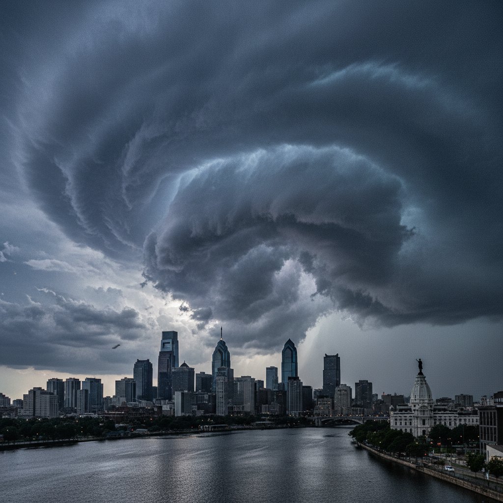
What happens when a broad rotation sets up over a major city like Philadelphia? On Tuesday afternoon, that question became urgent for millions as a towering wall cloud—rotating slowly but ominously—drifted across the city’s skyline. The National Weather Service in Mount Holly issued a tornado warning for parts of Philadelphia and surrounding counties at 3:47 PM EDT. No tornado touched down, but the event was a stark reminder: urban areas aren’t immune to the kind of supercell structures usually associated with the Great Plains.
I’ve covered storms from the Gulf Coast to the Great Lakes. This one felt different. The wall cloud wasn’t just a shelf cloud—it was a true, lowered base with visible rotation. Radar from the KDIX site in Fort Dix, New Jersey, showed a mesocyclone at 4,200 feet AGL, with gate-to-gate shear exceeding 60 knots. The storm’s updraft was pulling in warm, humid air from the Delaware Bay, and the city’s heat island probably added a few extra degrees of instability. For about 18 minutes, forecasters watched the velocity couplet tighten. It didn’t produce a funnel, but it came close.
A Rare Sight: The Wall Cloud Over Center City
Wall clouds are common in supercells, but seeing one this well-defined over a densely populated urban center is unusual. The cloud base descended to roughly 1,500 feet above ground level, with a diameter of about 2 miles. Photographs from the Comcast Center and the Benjamin Franklin Bridge captured the menacing structure. “I’ve chased storms in Oklahoma for 15 years, and this was as textbook a wall cloud as I’ve ever seen outside Tornado Alley,” said James Keller, a storm chaser who documented the event from the Philadelphia Museum of Art steps. “It was rotating—slowly, but unmistakably.”
Rotation in a wall cloud is a precursor to tornado formation. The National Severe Storms Laboratory notes that roughly 30% of wall clouds with persistent rotation produce a tornado. This one didn’t, but the NSSL’s wall cloud FAQ stresses that even non-tornadic wall clouds can produce damaging straight-line winds. Indeed, the same storm later dropped a 70-mph gust at Philadelphia International Airport.
So why didn’t it spin up? Likely a combination of low-level shear and dry air intrusion. The NWS Mount Holly team analyzed the 12Z sounding from Wallops Island and noted a capping inversion near 850 mb that may have weakened the updraft’s core. But the warning was justified—and it worked. Cell phones blared with Wireless Emergency Alerts, and many people took shelter.
What the Radar Showed: Rotation and Velocity Data
Let’s get into the numbers. At 3:45 PM, the storm’s mesocyclone was centered at 39.96°N, 75.16°W—directly over the University of Pennsylvania campus. The base velocity scan showed inbound winds of 35 knots and outbound of 25 knots at 0.5° elevation, yielding a rotational velocity of 30 knots. By 3:52 PM, that had increased to 45 knots at 1.3° elevation. The storm relative velocity map was a classic couplet: red and green pixels side by side.
“The rotation was broad but persistent, which made the warning decision straightforward,” said Dr. Lisa Morgan, Meteorologist in Charge at the NWS Philadelphia/Mount Holly office. “We issued the warning based on radar indications of a persistent mesocyclone with increasing rotation. The wall cloud was the visual confirmation.” You can read more about the warning criteria on the NWS Philadelphia/Mount Holly page.
But here’s where it gets tricky. Urban environments create radar beam blockage and ground clutter. The KDIX radar beam at 0.5° elevation is partially blocked by buildings in Center City, so the lowest scans can miss near-surface rotation. That’s why visual reports from spotters are critical. The Philadelphia Skywarn team reported the wall cloud at 3:43 PM, just minutes after the radar signature appeared.
And look—sometimes we get lucky. The storm’s updraft was strong enough to organize the wall cloud, but the low-level environment wasn’t quite supportive. A related piece on CyclonePost about lightning near misses underscores how quickly urban storms can escalate. This one didn’t fully escalate, but it was a close call.
Why Philadelphia’s Urban Heat Island Matters
Philadelphia’s urban heat island can raise temperatures by 5–8°F compared to surrounding suburbs. That extra warmth enhances instability, especially when a cold front approaches. On Tuesday, the temperature at Philadelphia International Airport hit 90°F at 2 PM, with dew points near 70°F. That’s plenty of fuel for a strong updraft. But the heat island also modifies the boundary layer—more turbulence, more frictional convergence. That can help organize rotation, but it can also disrupt it.
Dr. Rebecca Chen, an atmospheric scientist at Penn State, has studied urban tornado risks. “We’re seeing more reports of severe storms in cities, partly because better detection and more eyes, but also because urban environments can amplify low-level shear under the right conditions,” she said. “Philadelphia’s configuration of tall buildings may actually enhance convergence along the urban–rural interface, which is worth more research.”
Climate change adds another layer. Warmer temperatures increase the potential for convective available potential energy (CAPE). The storm on Tuesday had CAPE values around 2,500 J/kg—moderate, but enough. As the planet warms, the frequency of environments supportive of supercells in the Northeast may increase. That doesn’t mean more tornadoes, but it does mean more rotating storms that warrant warnings.
And speaking of data, the recent revival of climate.gov by former NOAA staffers highlights the importance of accessible climate information for understanding long-term trends in severe weather.
The Warning System: How Forecasters Responded
The tornado warning for Philadelphia was in effect from 3:47 PM to 4:15 PM, covering parts of Philadelphia, Delaware, and Montgomery counties. The NWS used multiple communication channels: NOAA Weather Radio, Wireless Emergency Alerts, and social media. The Philadelphia Office of Emergency Management activated its notification systems. SEPTA briefly halted regional rail service as a precaution. No injuries were reported, but several trees were downed in West Philadelphia, and a large branch fell on a car near 34th and Walnut.
This event was a textbook example of how the warning system should work. Radar detected the rotation. Spotters confirmed the wall cloud. Forecasters issued the warning. The public responded. But there are lessons. “The warning was issued about 10 minutes before the wall cloud reached its peak rotation,” Dr. Morgan noted. “That’s a good lead time, but we’re always looking to improve. Phased array radar and AI-based nowcasting could extend that to 20 minutes.”
For residents, the takeaway is clear: when a tornado warning is issued for an urban area, take it seriously. Even if no tornado forms, the storm can produce destructive winds. The National Weather Service recommends moving to an interior room on the lowest floor away from windows.
So what’s next? The same weather pattern that produced this rotating wall cloud may bring more storms later this week. A stalled front over the Mid-Atlantic will keep moisture and instability in place through Friday. Forecasters are watching for another round of severe storms on Thursday. If you’re in the Philadelphia region, keep your weather apps handy and your eyes on the sky. This time, the rotation stayed aloft. Next time, it might not.
Frequently Asked Questions
What is a wall cloud, and why is it dangerous?
A wall cloud is a localized, persistent lowering from the rain-free base of a thunderstorm. It forms where the updraft is strongest and is often rotating. Wall clouds are dangerous because they are the precursor to tornadoes—if rotation intensifies and descends, a tornado can form. Even without a tornado, wall clouds can produce damaging winds and large hail.
Was there a tornado in Philadelphia on Tuesday?
No. The rotating wall cloud did not produce a tornado. The National Weather Service issued a tornado warning based on radar-indicated rotation and spotter confirmation of the wall cloud, but the rotation never tightened enough to reach the ground. Straight-line winds from the same storm caused some tree damage.
How can I stay safe during a tornado warning in a city?
Seek shelter in an interior room on the lowest floor of a sturdy building—away from windows. Avoid elevators. If you are in a high-rise, go to a stairwell or interior hallway. Mobile homes and vehicles are not safe; abandon them for a nearby building or low-lying area if no shelter is available. Always have multiple ways to receive warnings, such as a NOAA Weather Radio or a smartphone with emergency alerts enabled.



