“We’re watching a powder keg of atmospheric dynamics, and the fuse is getting shorter by the day,” warns Dr. Elena Torres, a senior climatologist at the National Oceanic and Atmospheric Administration (NOAA). Her voice carries an urgency that’s hard to ignore. For weeks, her team has been tracking an unprecedented convergence of warm ocean waters, shifting jet streams, and stalled high-pressure systems. The result? A storm that’s not just brewing — it’s accelerating. And for millions of Americans from the Gulf Coast to the Mid-Atlantic, the clock is ticking.
This isn’t hyperbole. Look at the data. Sea surface temperatures in the Gulf of Mexico are running 3 to 5 degrees Fahrenheit above the 30-year average, according to NOAA’s latest reports. That’s the kind of heat that supercharges thunderstorms, turns a tropical wave into a hurricane, and — when combined with a stalled atmospheric river — can park a deluge over a city for days. And that’s exactly what forecasters are now warning could happen within the next 72 hours.
The Anatomy of an Impending Disaster
So what’s actually going on up there? Imagine a massive atmospheric tug-of-war. A stubborn ridge of high pressure over the southeastern US is blocking the normal westward movement of weather systems. Meanwhile, a powerful low-pressure trough is digging down from Canada, pulling in a firehose of tropical moisture from the Caribbean. These two forces are about to collide.
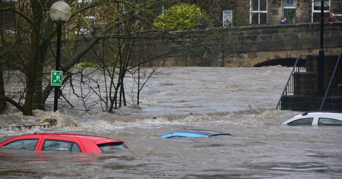
“It’s like slamming two freight trains together,” explains Mark Chen, a meteorologist with the National Weather Service in Mobile, Alabama. “The high pressure acts as a wall. The low pressure can’t move. So the moisture just piles up and unloads. We’re looking at rainfall totals of 10 to 15 inches in a 24-hour period, with isolated spots potentially hitting 20 inches.” That’s enough to turn streets into rivers, overwhelm levees, and trigger catastrophic flash flooding from Houston to Tampa to Charleston. The National Weather Service has already issued flash flood watches for 14 states.
But this storm isn’t just about water. The same setup is expected to spawn violent thunderstorms capable of producing tornadoes. The Storm Prediction Center has placed much of the Gulf Coast under a “moderate risk” for severe weather — the second-highest level on their scale. And here’s the gut punch: Many of these communities are still recovering from hurricanes and floods over the past two years. They’re exhausted. Their infrastructure is frayed. A new crisis isn’t just a possibility — it’s a probability.
Human Impact: Who’s in the Crosshairs?
Let’s get specific. Mobile, Alabama. Pensacola, Florida. New Orleans, Louisiana. These cities are staring down the barrel. In New Orleans, the city’s aging drainage system — a patchwork of pumps and canals that struggle even in a routine thunderstorm — is facing a test it wasn’t built for. “Look, we’ve got pumps that are 50 years old,” says Joseph Broussard, a retired civil engineer who worked on the city’s flood protection system for three decades. “They can handle maybe 6 inches of rain in a day. This storm could drop that in an hour. It’s not a question of if the system fails — it’s a question of how badly.”
And it’s not just the coasts. Inland areas, particularly along the Tennessee and Mississippi River valleys, could see flash flooding from runoff. The CDC notes that just six inches of moving water can knock a person down, and a foot of water can sweep a car away. But people don’t always listen. We’ve seen it before: drivers ignoring barriers, families waiting too long to evacuate. This time, the window is narrow.
The silent crisis of heat-related deaths earlier this summer should have been a wake-up call. But when disasters pile up year after year, communities become numb. That’s dangerous. Because this storm isn’t just a weather event — it’s a stress test for our social fabric. Emergency managers are already warning that shelters may fill up fast, and that people with medical needs — oxygen-dependent patients, dialysis patients — need to make plans now.
What This Means for You — and What You Should Do
If you live anywhere from Texas to the Carolinas, this is not a drill. Forecasters are urging people to prepare now, before the rain starts. That means charging your devices, filling up your gas tank, stocking non-perishable food and water, and knowing your evacuation routes. Yes, it sounds like a broken record. But the broken record is the one that saves lives.
“The most dangerous phrase in a disaster is ‘I thought it wouldn’t be that bad,'” says Dr. Torres. “We have the technology to see these storms coming. We don’t have a technology to make people pay attention.” She’s right. In a world of climate whiplash — where a record-breaking heat dome can be followed a week later by catastrophic flooding — the new normal is that the abnormal is normal.
And here’s something you might not think about: the aftermath. After the floodwaters recede, the risk of waterborne disease rises. Mold sets in within 24 to 48 hours. Power outages could last for days or weeks. The Federal Emergency Management Agency is already staging supplies in Alabama and Florida, but FEMA can’t be everywhere at once. That’s why local resilience matters. Check on your neighbors — especially the elderly. They’re often the ones who slip through the cracks.
Look, this is heavy. There’s no way to sugarcoat it. A storm is brewing, and a crisis is imminent. But here’s the other side: We’ve been here before. We’ve faced hurricanes, floods, and fires. We’ve rebuilt. The question is: Will we rebuild smarter? Or will we just keep gambling with the weather? Because the house always wins.
For now, the best we can do is watch the radar, listen to the experts, and take action. The storm is coming. The only question is how ready we are to meet it.
Frequently Asked Questions
How can I prepare for flash flooding if I live in a low-lying area?
Start by checking your local flood zone maps on the FEMA Flood Map Service Center. Elevate critical utilities like your furnace and electrical panel if possible. Keep sandbags on hand, move valuables to higher floors, and have a go-bag ready with meds, documents, and cash. Never try to drive through floodwaters — turn around, don’t drown.
What’s the difference between a flash flood watch and a warning?
A flash flood watch means conditions are favorable for flash flooding — you should be ready to act. A warning means flooding is imminent or already happening — you must get to higher ground immediately. Watches can be issued hours in advance; warnings are often issued minutes before the water rises.
Why is this storm so dangerous compared to others this year?
This setup combines extreme rainfall potential — up to 20 inches in some areas — with a stalled weather pattern that won’t move. That’s a recipe for torrential, prolonged flooding. Additionally, the warm Gulf waters are supplying extra energy, increasing the risk of tornadoes and severe thunderstorms embedded within the rain bands.