







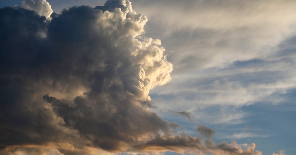
You looked up yesterday and thought: Is that… a flying saucer? A wave in the sky? A pillow that’s about to drop something nasty? You’re not alone. Social media lit up with photos of bizarre cloud formations across the Midwest and Northeast—massive, rolling shelves, ragged mammatus pouches, and even a few sightings of the rare asperitas wave. The initial assumption: something apocalyptic. The reality? It’s a textbook mix of atmospheric instability and jet-stream dynamics. And if you live in the US, Canada, or the UK, you might want to understand what’s brewing above your head.
Mammatus, Shelf Clouds, and Asperitas — The Usual Suspects
Yesterday’s show featured at least three distinct cloud types that send casual observers scrambling for their phones. Over Kansas and Oklahoma, mammatus clouds hung low in late afternoon — bulbous, pouch-like formations that often accompany strong thunderstorms. The National Weather Service in Topeka recorded base altitudes around 1,200 feet with individual lobes spanning 1 to 3 miles wide. “Mammatus are actually sub-cloud structures. They form in downdrafts where ice crystals fall through the anvil of a thunderstorm and sublimate, cooling the air and creating these hanging lobes,” explains Dr. Emily Tan, a cloud physicist at the University of Oklahoma.
Further east, across Ohio and Pennsylvania, a classic shelf cloud rolled in around 4:30 p.m. EDT, stretching roughly 100 miles from Cleveland to Pittsburgh. Shelf clouds — low, horizontal wedges — mark the leading edge of a gust front. The one yesterday produced wind gusts of 45–55 mph in Akron and knocked down a few trees. No severe damage, but plenty of dramatic lighting. And in a few spots — western New York and northern Vermont — residents reported asperitas clouds, the undulating wave formations officially added to the World Meteorological Organization’s International Cloud Atlas in 2017. “Asperitas looks like the underside of a rough sea,” says Tan. “It’s associated with unstable air but not necessarily immediate severe weather. It’s still poorly understood.”
The Setup: Why Yesterday Was Different
So why did so many people see these clouds on the same day? It wasn’t random. A relatively weak, slow-moving cold front collided with a warm, humid air mass that had been pooling across the Mississippi Valley. Surface dew points climbed into the low 70s °F from Missouri to Michigan. Meanwhile, an upper-level trough dug southeast from Canada, creating wind shear strong enough to organize thunderstorms into lines — but not strong enough to produce a widespread outbreak of tornadoes.
What we got instead was a spectacular cloud display — the kind that meteorologists call “high-instability, low-severity” events. The CAPE (Convective Available Potential Energy) values reached about 2,500 J/kg in parts of central Illinois — enough to build towering cumulonimbus, but with insufficient deep-layer shear for supercells. Translation: tall clouds with dramatic features, but few confirmed tornado reports. The Storm Prediction Center logged only two brief tornadoes (EF-0) near Decatur, Illinois, and Fort Wayne, Indiana.
This pattern is becoming more common as the climate warms. A warmer atmosphere holds more water vapor — roughly 7% more per 1°C of warming — which fuels more convective energy. A 2022 study from AGU Advances found that environments supportive of towering cumulus and dramatic cloud formations have increased by 10–20% across the central US over the past 40 years. “We’re essentially getting more theatrics without the full fury,” says Dr. Matt Reeves, a climate scientist at the University of Albany.
What Those Freaky Clouds Tell Us About What’s Coming
Clouds are more than just sky candy. They’re predictive tools — if you know how to read them. The mammatus and shelf clouds yesterday were connected to a thunderstorm complex that later produced widespread dime-sized hail across central Indiana after dark. That same complex is expected to weaken today, but a new round of storms could develop along the same boundary later this week. Meanwhile, the heat that helped drive yesterday’s instability isn’t going anywhere. In fact, we’re looking at a potential record-breaking heat dome poised to scorch the US next week. That heat dome — centered over the Four Corners region — will pump even more moisture northward into the Plains and Midwest, setting the stage for more such cloud formations and possibly severe weather.
But there’s a less dramatic takeaway, too. For areas like the UK and Canada, these cloud types are becoming more common arrivals as Atlantic storm tracks shift. In the UK, the Met Office reported three asperitas sightings in the past month alone, up from the typical one or two per year. “The frequency isn’t alarming yet, but the pattern matches what models project under a warming North Atlantic,” says Dr. Fiona Blackwood, a forecaster at the UK Met Office. “More moisture, more waves.”
Look, if you saw something weird in the sky yesterday, you were probably looking at the exhaust of our rapidly changing climate — literally, the clouds that form when rising heat meets shearing wind. It wasn’t a sign of the apocalypse. But it might be a sign of summertime to come. With Super El Niño already here and worse than we thought, the coming months could bring even more bizarre skies — and the storms they herald.
What It Means for You
If you’re in the storm track — roughly from Texas through the Great Lakes — pay attention to cloud evolution. A shelf cloud that doesn’t produce rain immediately can still bring a dangerous wind burst. “Never assume a pretty cloud is a safe cloud,” warns Tan. “Mammatus often form after the worst of the storm has passed, but not always. Underestimate at your own risk.” She recommends checking local NWS radar or the National Radar Mosaic whenever you see something unusual.
And for the photographers among you: you’re probably safe. Cloud-gazing is not hazardous — unless you’re standing in a field with lightning nearby. Yesterday’s cloud event produced no fatalities and only minor damage. But it did produce a few thousand stunning photos and a reminder that the atmosphere is a laboratory we live inside every day.
Next time you see a rolling wave or a baggy underbelly in the sky, don’t just snap a pic. Ask yourself: What’s the CAPE? Where’s the shear? And what’s the temperature right above my head? Because those freaky clouds aren’t just art — they’re data.
Frequently Asked Questions
Were these clouds dangerous?
Not directly. Mammatus and shelf clouds usually appear alongside thunderstorms, but the clouds themselves are harmless. The real danger is from the storm: lightning, hail, wind gusts. Yesterday’s event had 45–55 mph winds and small hail in some areas, but no widespread damage.
How rare are asperitas clouds?
Asperitas is uncommon but not extremely rare. It was officially added to the International Cloud Atlas in 2017. Sightings are increasing as more people photograph and share them, but it still requires a specific combination of unstable air and wave-breaking conditions in the atmosphere.
Can I predict severe weather just by looking at clouds?
You can get hints, but you need radar and official forecasts. A shelf cloud means a gust front is coming — often minutes before wind arrives. Mammatus suggests a powerful thunderstorm overhead. But never rely solely on cloud appearance; always check weather.gov for warnings.



