







“This is not your typical summer heat. We’re looking at a multi-day event where heat indices will approach 110°F in the urban core — that’s a level where even healthy people can get into trouble quickly.”
New York City is staring down the barrel of a severe heatwave next week that meteorologists are calling potentially record-breaking. High pressure is expected to park over the Northeast from Monday through Friday, pulling a mass of hot, humid air up from the Gulf Coast. The National Weather Service has already posted excessive heat watches for all five boroughs, with daytime highs forecast to reach 100°F (37.8°C) and overnight lows barely dipping below 80°F (26.7°C). That combination — intense daytime heat plus no nighttime relief — is the kind of pattern that killed more than 350 people in New York during the 1995 heatwave. And this one could be worse.
The peak is expected Wednesday and Thursday, with heat indices — what the temperature actually feels like when humidity is factored in — topping out at 110°F (43.3°C) in Manhattan and parts of Brooklyn. “The city’s asphalt and concrete will absorb heat all day and radiate it back at night,” says Mark Rivera, a meteorologist with the National Weather Service’s New York office. “That creates a compounding effect. It’s not just a couple of hot afternoons; it’s a prolonged stress event for the entire system.” Rivera noted that similar conditions earlier this month led to a July 4 heat wave that caught many off guard — and this one is projected to be more intense.
The Forecast: What to Expect
Let’s get specific. According to the NWS’s latest model runs, the high-pressure ridge will begin strengthening Sunday night. By Monday morning, temperatures at LaGuardia Airport (40.7769°N, 73.8740°W) are expected to hit 95°F by noon. Tuesday: 98°F. Wednesday and Thursday: 100–102°F. The heat index will peak each afternoon between 3 and 5 p.m. — the same hours when the city’s subway platforms become literal ovens, hitting 110°F-plus. Central Park’s official recording station (40.7829°N, 73.9654°W) may break its all-time July high of 106°F, set in 1936.
Humidity will be the real killer. Dew points in the mid-70s will make the air feel soupy and thick. Combine that with the heat index formula used by the National Weather Service, and you get apparent temperatures that exceed 110°F. That’s the threshold where the CDC recommends canceling outdoor events and limiting strenuous activity entirely. The city’s Office of Emergency Management is already coordinating with Con Edison to prepare for potential rolling blackouts if demand spikes — which it almost certainly will.
But here’s the thing that doesn’t get talked about enough: the overnight lows. In a typical heatwave, temps drop to 70°F or so at night, giving bodies a chance to cool. Not this time. Lows in midtown Manhattan will struggle to fall below 83°F. That’s dangerous because it means the human body never gets a break from heat stress. Over multiple days, that’s how heatstroke sets in — especially for older adults, people with chronic conditions, and anyone without air conditioning.
Health Risks and Public Response
The New York City Department of Health and Mental Hygiene is activating its Heat Emergency Plan on Monday morning. That means extended hours at public pools, opening cooling centers in libraries and community centers across all five boroughs, and deploying mobile units to check on vulnerable populations. “We’re particularly worried about the elderly in public housing towers that lack central AC,” says Dr. Susan Park, NYC’s deputy commissioner for environmental health. “Last summer we had 14 heat-related deaths in Brooklyn alone. We cannot afford to repeat that.”
Park urged residents to check on neighbors and follow NIOSH heat stress guidelines: drink water every 15–20 minutes, avoid alcohol and caffeine, wear light clothing, and never leave children or pets in parked cars — even for a few minutes. Interior car temperatures can hit 140°F in less than 10 minutes on a 100°F day. That’s fatal.
Hospitals across the region are bracing for a surge in heat-related emergency visits. NYU Langone, Mount Sinai, and NewYork-Presbyterian have all told staff to prepare for an influx of patients with heat exhaustion, heat cramps, and the more severe heatstroke — defined by a core body temperature above 104°F and central nervous system dysfunction. Symptoms include confusion, slurred speech, loss of consciousness, and hot dry skin (because the body stops sweating toward the end).
The Urban Heat Island Factor
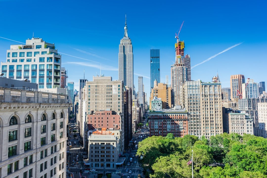
New York City is one of the most extreme examples of the urban heat island effect in the United States. Its 1.1 million buildings, 6,000 miles of asphalt streets, and a skyline of glass and steel absorb solar radiation all day and release it slowly at night. Satellite data from NASA’s ECOSTRESS instrument shows that surface temperatures in parts of the South Bronx and northern Manhattan can be 15–20°F hotter than surrounding suburbs like Westchester or Long Island. This is where the heatwave hits hardest.
And it’s not just a geography problem — it’s political. As Europe’s heat politics have shown, access to air conditioning has become a contested issue, but in New York, it’s a matter of survival. About one in five NYC households — roughly 500,000 people — do not have air conditioning, and many who do can’t afford to run it. The city’s program offering free AC units to low-income seniors has distributed 74,000 units since 2018, but the waiting list still tops 30,000 people. “The haves and have-nots in a heatwave are separated by a working window unit,” says Tran. “That’s a policy failure that shows up every summer.”
The EPA’s Heat Island Reduction Program recommends reflective roofs, green roofs, and street trees to combat this. New York has made progress — albedo standards for new construction and a million-tree planting initiative — but the benefits are long-term. For next week, those interventions won’t drop a single degree.
What This Means for New Yorkers
So what should you actually do? First, know the signs of heat illness and act fast. If you or someone near you feels dizzy, nauseous, or has a pounding headache — get to a cooled space immediately. Second, check the NWS heat safety page for the latest watch/warning status. Third, don’t rely on fans alone. When the air temperature exceeds 95°F, fans just move hot air around and can actually accelerate dehydration by increasing sweat evaporation without cooling the body core. Use them only if you also have an air-conditioned room to retreat to.
Transit will be a nightmare. The MTA has warned that subway service may be slowed due to heat-related track buckling; numerous delays are expected. The LIRR and Metro-North have also issued slowdown advisories. If you can work from home, now’s the time. And if you have to go outside, carry water — at least a liter — and wear a wide-brimmed hat. Avoid the peak sun hours of 11 a.m. to 4 p.m. if possible.
Look, nobody likes being told to stay inside during summer. But this isn’t typical beach weather. It’s a dangerous weather event with a death toll potential. The city has opened 500 cooling centers — find the nearest one by calling 311 or checking the city’s website. Libraries, senior centers, and some public schools will be open for extended hours.
The heatwave is expected to break by Saturday as a cold front pushes through, bringing thunderstorms and highs back to the mid-80s. Until then, treat it like a snowstorm, but hotter. No, seriously — respect this one. The numbers don’t lie.
Frequently Asked Questions
How hot will it actually get in NYC next week?
Forecasts show daytime highs of 100–102°F (37.8–38.9°C) on Wednesday and Thursday, with heat indices — the “feels like” temperature — reaching 110°F (43.3°C). Overnight lows will stay above 80°F (26.7°C), providing little relief.
Where can I find a cooling center near me?
Call 311, visit the NYC Emergency Management website, or check the city’s online cooling center locator. Over 500 centers are open, including libraries, community centers, and senior centers. They are free and accessible to all.
Why is this heatwave different from a typical summer hot spell?
The prolonged duration — five consecutive days of extreme heat — combined with high humidity and very warm nights dramatically increases the risk of heat-related illness and death. Urban heat island effects amplify temperatures in dense neighborhoods, especially in the Bronx and northern Manhattan. This type of multi-day event strains the power grid and overwhelms cooling resources.



