For hundreds of thousands of residents along Mexico’s Pacific coastline from Oaxaca to Jalisco, the primary threat from Hurricane Boris (02E) is not the wind—it’s the water. The storm, which strengthened into a Category 1 hurricane early Tuesday morning, is expected to unleash rainfall totals of 8 to 12 inches across mountainous terrain, triggering life-threatening flash floods and mudslides from Puerto Escondido to Manzanillo.
As of 09:00 UTC on August 15, the National Hurricane Center (NHC) placed Boris’s center near latitude 14.8°N, longitude 98.2°W—approximately 200 miles south-southeast of Acapulco. Maximum sustained winds have reached 75 mph (120 km/h) with a minimum central pressure of 985 mb. The storm is tracking west-northwest at 12 mph, paralleling the coast but remaining just offshore.
Storm Structure and Forecast Track
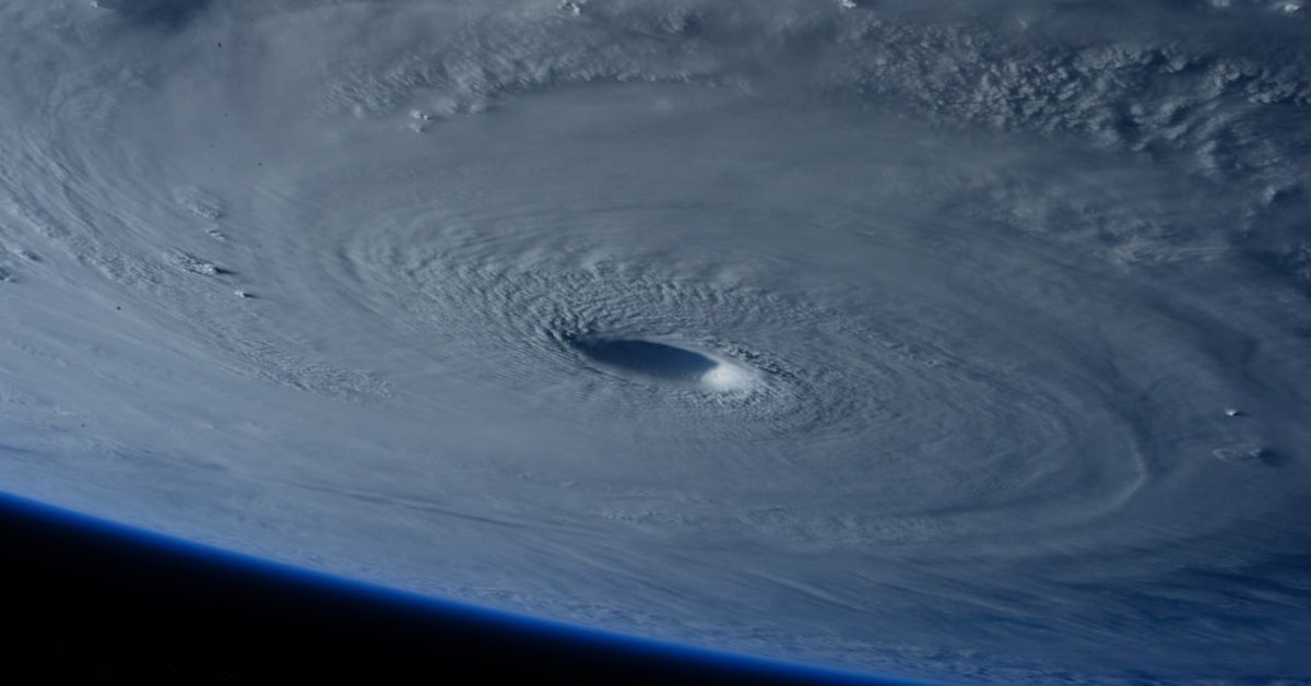
Satellite imagery shows a well-defined central dense overcast with a developing eye feature. Upper-level outflow remains robust, and sea surface temperatures in the Eastern Pacific are hovering near 30°C (86°F), providing ample fuel for further intensification. The NHC’s five-day forecast cone indicates Boris could reach Category 2 strength by Wednesday, with winds near 100 mph (160 km/h), before encountering cooler waters and increasing shear later in the week.
“This is a classic Eastern Pacific hurricane development scenario—warm water, low shear, and a moist atmosphere,” said Dr. Elena Torres, senior hurricane specialist at NOAA’s Atlantic Oceanographic and Meteorological Laboratory. “The key uncertainty is how close the center gets to the coast. Even if the eye remains offshore, the rainbands will extend over land, and that’s where the real danger lies.”
“The primary hazard here is not the wind—it’s the water. Coastal residents should prepare for prolonged heavy rain, not just a 12-hour squall.” — Dr. Elena Torres
Impacts on Coastal Communities and Maritime Operations
Mexico’s Servicio Meteorológico Nacional (SMN) has issued hurricane warnings from Punta Maldonado to Cabo Corrientes, and tropical storm warnings extend further north to Mazatlán. Ports in Acapulco, Lázaro Cárdenas, and Manzanillo are closed to all vessel traffic. Cruise ship itineraries have been altered, and cargo operations are suspended. The port of Acapulco, which handles roughly 2.5 million tons of cargo annually, reported zero vessel movements as of 06:00 local time.
Boris is expected to produce a dangerous storm surge of 3 to 5 feet above normal tide levels along the immediate coastline, with large battering waves. The SMN warns that coastal flooding could reach up to 1 mile inland in low-lying areas such as the Costa Chica region of Guerrero. Rip currents already extending 100 yards out have been reported from Zihuatanejo to Ixtapa, prompting beach closures and warnings for swimmers.
Rainfall is the most widespread threat. Boris’s slow forward speed—12 mph—means tropical-storm-force winds extend out 60 miles from the center, but heavy rainbands reach more than 150 miles. The NHC estimates 8 to 12 inches of rainfall across the Mexican states of Guerrero, Oaxaca, Michoacán, and Colima, with isolated totals up to 18 inches in the Sierra Madre del Sur. This level of precipitation in mountainous terrain has historically caused catastrophic debris flows. In 2013, Hurricane Manuel—a similar storm—dropped 20 inches of rain and caused landslides that killed 123 people.
Historical Context and Broader Meteorological Patterns
Boris is the second named storm of the 2024 Eastern Pacific hurricane season, following Hurricane Aletta in early July. The season’s current activity aligns with forecasts from the Climate Prediction Center, which called for a 70% probability of above-normal activity due to a developing La Niña and near-record warm sea surface temperatures. The Eastern Pacific typically produces 15 to 18 named storms per year, but this year the window for development has opened earlier than usual.
“La Niña reduces vertical wind shear over the Eastern Pacific during the summer, creating a more conducive environment for hurricane formation,” explained Captain Mark H. Reyes, retired U.S. Navy meteorologist and consultant for CyclonePost. “We’re seeing storms like Boris tap into a very deep warm water layer. This storm has the potential to undergo rapid intensification if conditions hold.”
“We should view Boris not as an isolated event, but as a signal of what the rest of the season might deliver. The Eastern Pacific basin is primed for back-to-back systems.” — Captain Mark H. Reyes
Boris also draws attention because of its proximity to the Pacific Hurricane Highway—a corridor where storms often threaten the coast of Mexico. Historically, about 12% of Eastern Pacific hurricanes make landfall in Mexico. The most recent example is Hurricane Lidia in 2023, which struck near Puerto Vallarta as a Category 4. While Boris is not forecast to make a direct landfall, any slight wobble in its track could bring the eyewall over the coast between Acapulco and Zihuatanejo, a region with 1.2 million residents.
What This Means for Residents, Travelers, and Emergency Services
Local governments in Guerrero and Oaxaca have opened 300 shelters capable of housing 45,000 people. Schools are closed in 15 municipalities. The Mexican army (SEDENA) has deployed 2,500 troops for search and rescue operations. Residents in flood-prone areas are urged to stock three days of food and water, secure loose objects, and know their evacuation route.
For tourists vacationing in Acapulco, Ixtapa, or Puerto Escondido, the advice is simple: stay indoors, avoid coastal areas, and monitor local announcements. Several international airlines, including American Airlines, Delta, and Aeromexico, have waived change fees for flights to and from Acapulco International Airport (ACA) and Ixtapa-Zihuatanejo International Airport (ZIH). The Federal Electricity Commission (CFE) has staged repair crews in case of power outages.
Looking ahead, the long-range guidance suggests Boris will weaken to a tropical depression by Friday as it moves into cooler waters west of Baja California Sur. However, the moisture plume will linger, feeding thunderstorms across northwest Mexico and potentially into the U.S. Southwest by the weekend. The National Weather Service in Phoenix has already issued a flash flood watch for parts of Arizona and New Mexico due to the potential for remnant moisture combining with the monsoon. This means that even as Boris fades from view, its legacy could be felt hundreds of miles away. The storm serves as a stark reminder that in the hurricane business, the headline might be about wind and surge, but the last chapter is often written by rain and flood.