







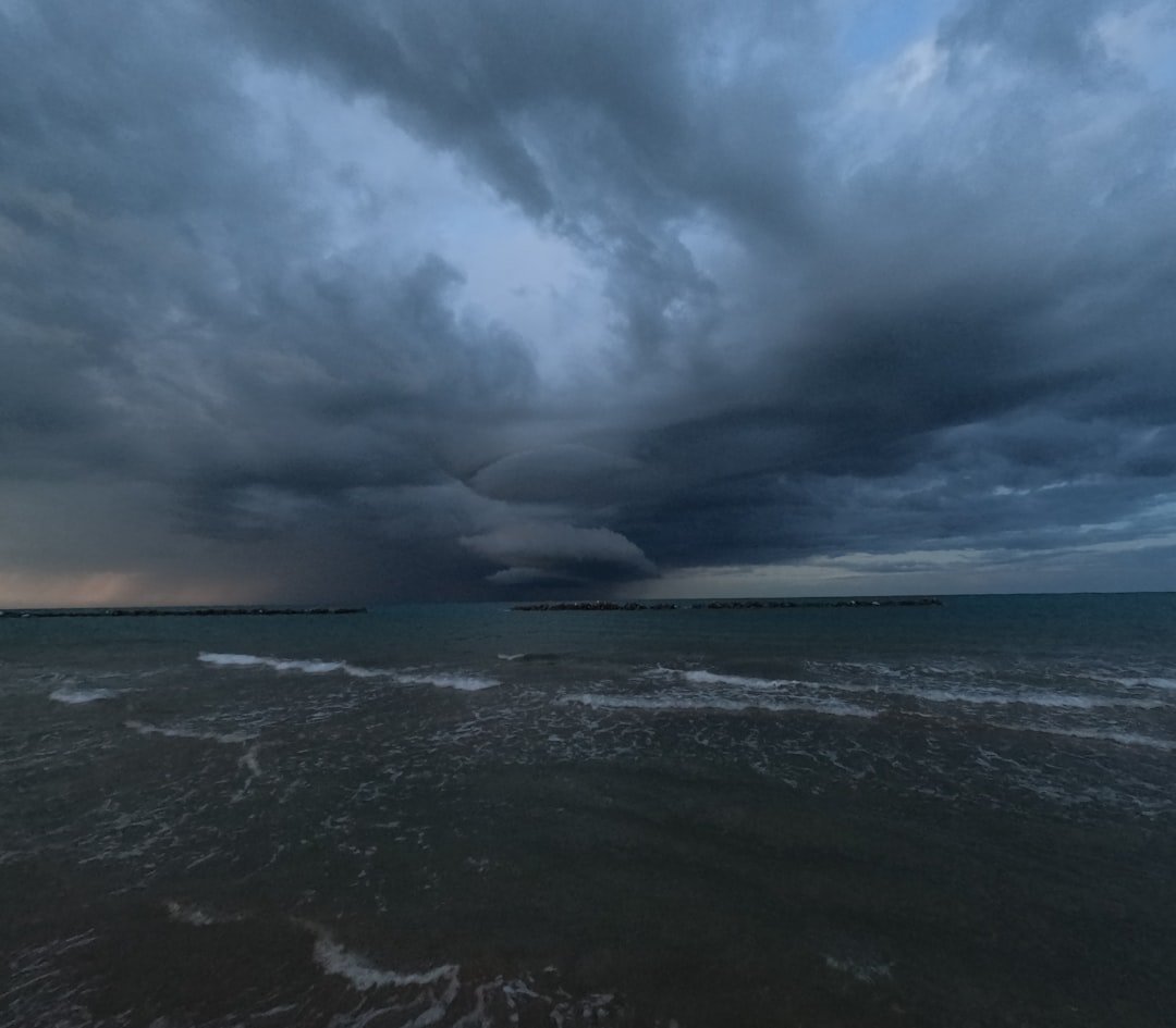
“It was like a freight train made of clouds,” recalls Dr. Elena Vasquez, a meteorologist at Florida State University. “You could see the structure rotating, the shelf cloud advancing. Nature doesn’t get more dramatic than that.”
Last Thursday afternoon, a timelapse video from Panama City Beach began circulating across social media. Shot by local storm chaser Kyle Ransom, the footage shows a massive squall line rolling in from the Gulf of Mexico, swallowing the horizon in under five minutes. The video — which has amassed over 2 million views on X — captures the moment a dark, undulating shelf cloud sweeps over the coastline, turning a bright, humid afternoon into an eerie twilight. Palm trees bend, beach umbrellas flip, and tourists scramble for cover. It’s the kind of visceral reminder that, in the Florida Panhandle, severe weather isn’t a question of if — it’s when.
But this wasn’t just any storm cell. This was a textbook example of a derecho-producing squall line, packing wind gusts estimated at 70 to 80 mph. The National Weather Service in Tallahassee issued a severe thunderstorm warning for Bay County at 3:47 PM ET, and within 15 minutes, the front had crashed ashore. The timelapse captured exactly what forecasters had predicted: a rapid transition from calm to chaos.
A Sudden Wall of Clouds: What the Timelapse Shows
The timelapse — shot at an interval of one frame per second — compresses roughly 10 minutes of real-time into a 30-second clip. The initial frames show a hazy blue sky with cumulus clouds building in the distance. Then, almost imperceptibly at first, the clouds begin to darken. The shelf cloud emerges as a rolling, horizontal arc — a classic sign of intense downdrafts pushing out ahead of the storm. Within seconds, the leading edge becomes a menacing wall, swallowing the skyline. Lightning flickers inside the cloud mass, though it’s largely obscured by rain curtains.
“Shelf clouds like this one are the visual signature of a mature thunderstorm complex,” explains Dr. Vasquez. “They form when cold air rushing out of the storm undercuts warm, moist air near the surface. That collision forces the warm air upward, creating that crisp, rolling appearance. It’s beautiful, but it’s also a warning: damaging winds are imminent.”
And damaging they were. The storm system knocked out power to over 12,000 residents in Bay and Walton counties. Trees snapped along Highway 98, and a construction crane at a condominium site in Panama City was reported bent. No fatalities were reported, but the National Weather Service confirmed three minor injuries from flying debris. The timelapse itself, while stunning, underscores a sobering reality: the Panhandle sits in a geographic bullseye for severe weather.
Severe Weather in the Panhandle: A Historical Perspective
The Florida Panhandle has long been a hotbed for severe thunderstorms, especially during the spring and early summer. The region’s geography — wedged between the Gulf of Mexico’s warm, moisture-laden air and the continental air masses sweeping down from the north — creates a collision zone that regularly spawns supercells and squall lines. Last week’s event is part of a pattern that extends back decades.
Consider April 2014, when a violent EF-3 tornado ripped through Pensacola, destroying 40 homes and killing two people. Or the devastating outbreak of February 2023, when a line of storms produced at least four tornadoes in the Panhandle, including an EF-2 near Destin. These aren’t anomalies. According to data from the NOAA Storm Prediction Center, the Panhandle averages 15 to 20 tornado warnings per year, with severe thunderstorm warnings numbering in the hundreds. The current storm, while not reaching tornado intensity, packed winds comparable to a Category 1 hurricane.
Dr. Vasquez points out that the timelapse serves as a teaching tool for both meteorologists and the public. “When people see that shelf cloud, I want them to think: get inside, now. Not: grab my phone and film it. But I understand the fascination — the raw power of the atmosphere is humbling.”
Meanwhile, across the United States, weather extremes are shifting. While the Panhandle faced this dramatic storm, other regions have been grappling with record-breaking heat. A recent article on Heat Wave Engulfs U.S. for July 4 highlighted how dangerously hot conditions blanketed the Midwest and Northeast. The contrast underscores a volatile pattern: some areas get slammed with storms, others bake under heat domes. And both can be lethal.
Climate Connections: Are Storms Getting More Intense?
It’s a question that arises after every dramatic weather event: is climate change making these storms worse? The answer, as with many complex systems, is nuanced. Warmer air holds more moisture — roughly 7% more per degree Celsius. That means thunderstorms have access to more fuel. When a storm like the one captured in the timelapse forms over the Gulf of Mexico, where sea surface temperatures have been running 1-2°F above average, the potential for heavy rain and strong winds increases.
“We can’t say any single storm is caused by climate change,” says Dr. Amir Khan, a climate scientist at the University of Miami. “But we can say that the environment in which these storms form is changing. Warmer oceans, higher humidity, and a more unstable atmosphere create conditions conducive to severe weather. The frequency of extreme rainfall events, for example, has increased by about 37% in the Southeast since 1958.”
Khan references NASA’s analysis of convective available potential energy (CAPE), which measures atmospheric instability. In the Gulf region, CAPE values have been trending upward over the past 40 years. Higher CAPE means stronger updrafts — and more violent storms. The Panhandle’s timelapse, with its towering cloud structure and rapid intensification, is consistent with that trend. NASA’s research on CAPE provides a detailed look at this metric.
But there’s another factor: sea level rise. The Panhandle’s coastline is especially vulnerable to storm surge from thunderstorms that produce strong onshore winds. While last week’s storm didn’t cause significant surge, it’s a reminder that these systems can pile water onto the coast even without a hurricane. The National Oceanic and Atmospheric Administration’s storm surge overview notes that even non-tropical systems can generate dangerous rises in water levels.
What You Need to Know: Safety and Preparedness
So what can residents and visitors take away from the timelapse? First, never ignore a severe thunderstorm warning. The tornado threat isn’t the only thing to fear — straight-line winds can be equally destructive. The Federal Emergency Management Agency recommends seeking shelter in an interior room on the lowest floor of a sturdy building when a warning is issued. Stay away from windows. And if you’re at the beach, get inland as quickly as possible; beachfront structures offer little protection against 80-mph gusts.
Second, understand that a shelf cloud is a visual cue. If you see one approaching, you have minutes — not hours — to act. The timelapse shows how fast the atmosphere can transition from serene to savage. “The most dangerous mistake people make is assuming they have time to watch and wait,” says Dr. Vasquez. “By the time you hear the roar, it’s almost too late.”
Finally, keep an eye on the broader seasonal outlook. This storm arrived on the heels of a relatively calm week, but the Panhandle’s severe weather season extends well into summer. The Storm Prediction Center’s day-to-day outlooks are a reliable source for staying informed. And as we’ve seen in other parts of the country, severe weather now comes in many forms — from heat waves to flash floods. Being prepared means understanding that the next dramatic timelapse could be happening outside your own window.
Looking ahead, meteorologists will continue to study storms like this one to improve radar detection and warning times. The timelapse, while a viral sensation, also serves as a data point. Dr. Vasquez’s team at Florida State is analyzing the footage alongside Doppler radar data to refine their models of shelf cloud propagation. “Every storm teaches us something,” she says. “The question is whether we’re willing to learn before the next one hits.”
Frequently Asked Questions
What is a shelf cloud and why is it dangerous?
A shelf cloud is a low, horizontal cloud formation that appears at the leading edge of a thunderstorm’s outflow. It’s a sign that strong, straight-line winds are about to hit. The cloud itself isn’t dangerous, but the winds it heralds can exceed 70 mph, causing structural damage and injuries from flying debris.
How common are severe storms in the Florida Panhandle?
Very common. The Panhandle experiences severe thunderstorms multiple times each year, particularly from March through July. Tornado warnings are issued an average of 15-20 times annually, and severe thunderstorm warnings are far more frequent. The region’s location between the Gulf of Mexico and continental air masses makes it a hotspot for squall lines.
Can I use timelapse videos like this to predict storms?
No. Timelapses are for documentation, not prediction. If you see a shelf cloud approaching in real time, you should immediately seek shelter — not start filming. For advance warnings, rely on National Weather Service alerts, weather apps, and NOAA weather radio.



