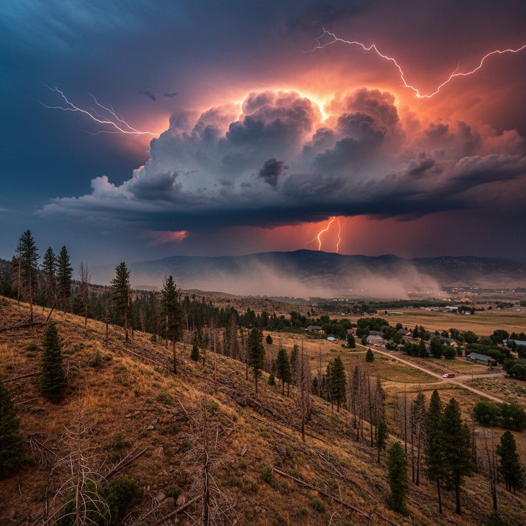
If you think you’ve seen the worst of wildfire season, you’re wrong. Right now, the risk across Utah and the broader Western US is the highest it’s been all year — and the numbers don’t lie.
We’re looking at a perfect storm of bone-dry fuels, single-digit humidity, and wind gusts topping 40 mph in vulnerable zones. By Friday afternoon, the Storm Prediction Center had already flagged a swath from southern Utah through Nevada and into Arizona as “critical” fire weather. This isn’t just a watch — this is an active, boots-on-the-ground alert for anyone who lives near wildland-urban interfaces, which is basically everyone from Salt Lake City suburbs to the outskirts of Las Vegas.
The Numbers Don’t Lie: Fuel Moisture Is at Record Lows
Let’s get specific. The National Interagency Fire Center recorded live fuel moistures in Utah’s Great Basin below 60% for the first time this season. Dead fuel moistures — the really scary stuff — have dropped to under 5% in pinyon-juniper woodlands across Washington County. To put that in perspective, when dead fuels hit 6%, any spark becomes a potential blowup. We’re below that threshold. And humidity? It’s forecast to drop to 8% in St. George on Saturday. Eight percent. That’s drier than a saltine cracker.
Look, I’ve covered wildfires from the California Sierra to the Colorado Front Range for nearly a decade. This pattern — a critical fire weather setup following a failed monsoon — is how the Brian Head Fire started in 2017 and how the Dixie Fire exploded in 2021. It’s the same signature: high pressure parking a heat dome overhead, sucking every molecule of moisture out of the landscape. The National Weather Service office in Salt Lake City issued a Red Flag Warning covering the entire western half of the state through Sunday night. That’s roughly 40,000 square miles of land where any fire start could become a sprint.
“We haven’t seen this level of combined heat, dryness, and wind alignment since the 2020 fire season, which was the most destructive on record for much of the West,” said Dr. Alison Toth, a fire meteorologist at the University of Utah. “The ingredients are all in place for rapid fire growth if a human-caused ignition occurs.”
The irony? Some of the same factors driving this wildfire risk are also making heatwaves feel worse globally. As explained in our analysis of why this heatwave feels worse, high overnight temperatures — staying above 70°F in many Utah valleys — prevent the natural recovery that usually gives firefighters a chance. No cool-down means no humidity recovery at dawn. Every hour of the day becomes a potential burn window.
What’s Driving This? The Failed Monsoon and a Stubborn Ridge
The North American Monsoon is supposed to bring thunderstorm moisture to the Four Corners region by mid-July. Instead, it’s been a dud across Arizona, Utah, and Nevada. Phoenix saw only 0.01 inches of rain in July — that’s less than 1% of normal. Flagstaff, normally a high-elevation wet spot, has recorded just 0.32 inches in two months. And those monsoon misses ripple north. When the monsoon fails over Arizona, the dry air feeds straight into southern Utah and Nevada, amplifying the fire danger.
But there’s a deeper, less understood factor at play here — and it’s not just a ridge of high pressure. Large-scale atmospheric waves, known as equatorial Rossby waves, are influencing the jet stream and locking this ridge in place. A recent article on equatorial Rossby waves as the hidden driver of extreme weather patterns explains how these tropical oscillations can create persistent blocking patterns that bake entire regions for weeks. That’s exactly what we’re seeing now: a blocking ridge over the interior West that’s been stationary since July 10.
And this isn’t just about the current weekend. Climatologists are pointing to longer-term trends. The 20-year average for large wildfire acreage in Utah has doubled since 2000. The state has seen six of its ten largest wildfires since 2018. This weekend’s conditions are setting the stage for another potential addition to that list.
“The real tragedy is that 90% of these ignitions are human-caused,” said Captain Ray Hernandez of the Utah Division of Forestry, Fire, and State Lands. “A dragging trailer chain, an unattended campfire, even a lawnmower blade striking a rock — any of these can be the match. And with conditions this extreme, we don’t get a second chance.”
Where the Risk Is Highest — And What to Do Now
If you’re in Utah, these are the hotspots to watch: Washington County (St. George area), Iron County (Cedar City), and the West Desert stretching toward the Nevada line. Further north, Tooele and Juab counties are also under Red Flag Warning through Saturday night. In Arizona, the risk extends from the Mogollon Rim north to the Utah border. Nevada’s risk is concentrated in the southern half — Clark, Nye, and Lincoln counties — where any lightning strike from dry thunderstorms could start something nasty.
But here’s what I tell people: don’t just watch the map. Prepare. Now. Clear dry grass within 30 feet of your home. Keep a go-bag with medications, documents, and pet supplies. Know two evacuation routes out of your neighborhood. Because when a wildfire blows up — and it can blow up in 15 minutes — you don’t get a warning call. You get a knock on the door or a text alert. And sometimes, you don’t even get that.
Utah’s population is growing fastest in these fire-prone exurbs. Communities like Ivins, Hurricane, and Enoch have exploded in population over the past decade, pushing housing developments right into pinyon-juniper woodlands. That’s a recipe for disaster. One match, one wind event, one afternoon — and you’ve got a catastrophe in the making.
Broader Implications for the West
This isn’t isolated to the Southwest quadrant. The same ridge is also affecting heatwave patterns across the UK, where record-breaking temperatures are rolling in. It sounds disconnected, but it’s the same global atmospheric circulation at work. The jet stream is wavy and locked in place, creating extreme events on both sides of the Atlantic. What happens in the West is part of a larger, interconnected system — one that shows no signs of stabilizing.
So what comes next? Sunday’s forecast actually shows a slight uptick in moisture over Arizona by Monday, but models disagree on whether that moisture will reach Utah. The European model says yes — a 20% chance of thunderstorms by Tuesday. The American GFS says no — the ridge holds firm through next Friday. Either way, this weekend is the flashpoint. And the message from every forecaster I’ve talked to is the same: assume the worst, prepare for it, and don’t let down your guard when the winds pick up.
This is the new normal in the West. And it’s only going to get more intense as the climate continues to warm and populations push further into fire-prone lands. The question isn’t whether a major fire will start this weekend — it’s where, and how fast it moves before anyone can stop it.
Frequently Asked Questions
What does a Red Flag Warning mean for residents in Utah and the West?
A Red Flag Warning is the highest fire weather alert issued by the National Weather Service. It signals that critical fire weather conditions are occurring or imminent — low humidity, strong winds, and dry fuels. During a Red Flag Warning, any fire start can quickly become uncontrollable. Residents are advised to avoid any outdoor activities that could create sparks, including using power equipment, target shooting, and campfires. Many jurisdictions implement burn bans during this time, and violators can be held liable for firefighting costs.
How can I protect my home from an approaching wildfire if I live in a high-risk area?
Start by creating a defensible space around your property. Remove all dead vegetation, dry leaves, and pine needles within 30 feet of your home—5 feet immediately next to the structure. Trim tree branches that overhang your roof. Use fire-resistant landscaping materials like rock and gravel near the house. Ensure your roof and gutters are clear of debris. Prepare an emergency go-bag with essential documents, medications, a change of clothes, and pet supplies. Know at least two evacuation routes and establish a communication plan with your family. Sign up for local emergency alerts—don’t wait for a knock on the door.
Why is wildfire season getting worse across the Western US?
Wildfire severity is increasing due to a combination of factors: climate change is driving hotter, drier conditions that dry out vegetation earlier and more completely; decades of fire suppression have left forests and shrublands overloaded with fuel; and population growth is pushing development deeper into fire-prone wildland-urban interfaces. The result is a feedback loop where each fire season primes the landscape for the next. Research from the University of Colorado shows that the annual area burned by wildfires in the Western US has increased by 400% since 1985, and the average fire duration has lengthened from under 7 days to over 37 days.