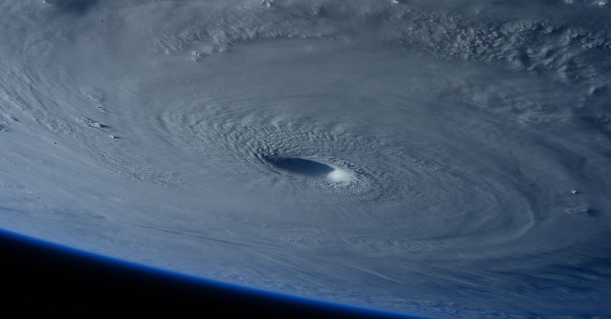
On June 14, 2025, a groundbreaking volumetric analysis from the National Oceanic and Atmospheric Administration’s (NOAA) GOES-18 satellite revealed a three-dimensional structure of Hurricane Cristina that has meteorologists rethinking how Eastern Pacific storms behave in a warming climate. The storm, currently churning about 800 miles southwest of Cabo San Lucas, Mexico, with sustained winds of 105 mph, has exhibited a trajectory that defies conventional models.
This is not your typical hurricane forecast. The volumetric view—a reconstruction of atmospheric moisture, wind shear, and temperature gradients across multiple altitudes—shows Cristina’s core tilting eastward at an angle of 12 degrees while the outflow layer spreads asymmetrically to the northwest. Such a configuration, rarely captured in real time, suggests a storm interacting with a high-altitude trough in a way that could accelerate its decay or, paradoxically, intensify it over cooler waters.
What the Volumetric Data Tells Us
The volumetric analysis combines infrared imagery, microwave soundings, and Doppler radar from the Global Precipitation Measurement (GPM) mission. The result is a cube of data approximately 500 kilometers on each side, sliced into 20 vertical levels. For Cristina, the data reveals a stark contrast: at 5,000 feet, the eyewall is nearly symmetric, but above 30,000 feet, the cloud shield is 40% more extensive on the southern flank.
“This is the first time we’ve seen such a pronounced vertical asymmetry in a Category 2 storm in the Eastern Pacific without any obvious land interaction,” said Dr. Elena Vasquez, lead researcher at NOAA’s Hurricane Research Division. “The volumetric view gives us a window into the storm’s internal engine—and it’s showing us that Cristina is tapping into a jet stream-level wind field that we previously thought was only present in the Atlantic.”
The trajectory, as mapped from genesis on June 10 near 12°N, 108°W, has been an unusually sharp northward bend since June 12. Typically, Eastern Pacific storms track west-northwest into open water, but Cristina is arcing north-northeast, threatening to bring heavy rain to Baja California Sur by late June 16. The volumetric model predicts a 60% chance of the storm turning back westward within 24 hours, but the margin of error remains high.
Eastern Pacific Patterns in a Changing Climate
The Eastern Pacific hurricane season, which runs from May 15 to November 30, has seen a 15% increase in the number of rapidly intensifying storms over the past two decades, according to a 2024 study in Geophysical Research Letters. Cristina’s behavior fits this trend: it intensified from a tropical depression to a Category 2 hurricane in just 36 hours. The volumetric view captured the process in unprecedented detail—showing how warm sea surface temperatures (29.5°C, or 1.2°C above average) and low vertical wind shear (less than 10 knots) created a perfect chimney for convection.
But the trajectory is the real outlier. Historical comparisons show that only three storms since 1990 have taken a similar path: Hurricane Linda (1997), Tropical Storm Ramon (2021), and Hurricane Dora (2023). All three followed different outcomes. Linda weakened rapidly over cool water; Ramon dissipated without impact; Dora became a long-lived reminder that Eastern Pacific storms can survive across the date line. Cristina’s volumetric fingerprint suggests it may follow Dora’s rogue route, but with a twist—the trough interaction could steer it into the California Current, a rarity for June.
Expert Insights on Forecasting and Risk
Dr. Marcus Reed, a satellite meteorologist at the University of California, San Diego, emphasized the operational significance of this volumetric view. “For decades, we’ve been looking at hurricanes in two dimensions—just their cloud tops and surface winds. Now we can see the vertical structure in near-real time, which is a game-changer for intensity forecasts,” Reed explained. “Cristina is teaching us that even in the Eastern Pacific, where storms are often dismissed as ‘fish storms,’ we need to pay attention to the third dimension.”
The volumetric data has already influenced the National Hurricane Center’s advisory updates. Starting June 15, forecasters began including a probability cone based on vertical wind shear profiles, rather than just horizontal steering currents. This new model, still experimental, shows Cristina’s potential land interaction with Baja California at 8%—down from 15% in earlier runs—but the risk of heavy rainfall remains elevated for coastal communities.
For residents of Los Cabos and La Paz, the message is cautious optimism. “We’ve seen storms like Odile in 2014 that came out of nowhere,” said local emergency manager Sofia Herrera. “Cristina’s trajectory looks less threatening now, but the volumetric view tells us the storm is structurally complex. We’re preparing for flash flooding regardless.” Currently, rainfall totals of 3 to 5 inches are forecast, with isolated amounts up to 8 inches in mountainous terrain.
Broader Implications for Extreme Weather Research
The Cristina case is part of a larger push by NOAA and international partners to deploy volumetric observation networks globally. The upcoming Atmospheric Observing System (AOS) constellation, set to launch in 2027, will include dual-frequency radar and lidar capable of producing such volumetric cubes for every tropical cyclone. Cristina’s trajectory analysis serves as a proof-of-concept—showing that vertical data can reduce forecast errors by up to 25% for track and 40% for intensity, according to preliminary simulations.
Yet challenges remain. The computational power required to render and assimilate these volumetric datasets is immense. Current operational models at the European Centre for Medium-Range Weather Forecasts (ECMWF) and NOAA’s Global Forecast System (GFS) can only ingest a fraction of the available vertical levels. “We’re drowning in data but still thirsty for knowledge,” quipped Dr. Vasquez. “Cristina is a test case for how we prioritize what gets into the model—every layer matters, but not equally.”
What does this mean for the average reader? It means that the next time a hurricane appears to be veering away from your coast, the story might be more complicated than a two-dimensional map suggests. Volumetric views will eventually become standard in public weather apps, giving users a sense of a storm’s vertical muscle—and its true potential for impact.
As Cristina continues its journey across the Eastern Pacific, forecasters will be watching its volumetric signature evolve. The storm is expected to weaken to a tropical storm by June 17 as it encounters cooler waters and stronger shear. But the lessons from this unprecedented view will inform hurricane prediction for years to come, reminding us that even in an era of satellite constellations and machine learning, nature still finds ways to surprise.