







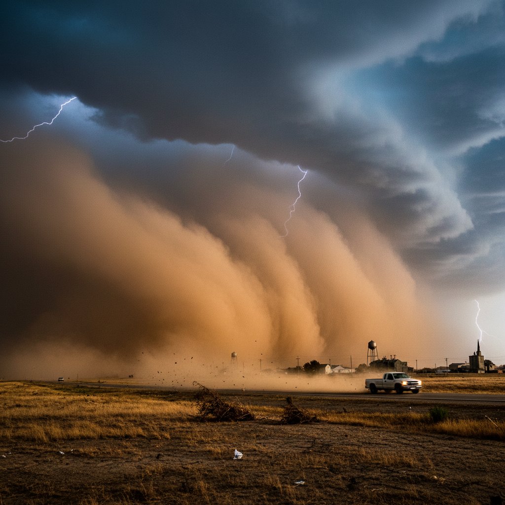
The horizon turned a dirty brown just after noon on Tuesday. For residents of Goodland, Kansas, it was a sight etched into the collective memory of the High Plains—a towering wall of dust advancing from the southwest, swallowing the sky mile by mile. The National Weather Service in Goodland issued a blowing dust advisory effective through the evening, warning of visibilities dropping to near zero along Interstate 70 and surrounding rural roads.
“It’s like somebody flipped a switch and the world just disappeared,” said Martha Jensen, a retired farmer who has lived in Sherman County for 37 years. “You can taste the dirt in your mouth before you even see it.”
The advisory, covering Sherman, Thomas, and Wallace counties, comes as sustained winds of 45 mph with gusts up to 65 mph scour topsoil from drought-parched fields. This is not a rare event in western Kansas, but the intensity of this particular plume—stretching at least 50 miles wide according to satellite imagery—has caught many off guard, raising concerns about respiratory health, road safety, and long-term soil loss.
A Historic Threat Returns to the High Plains
Dust storms were once a defining feature of life on the Great Plains, most famously during the Dust Bowl of the 1930s. Back then, waves of dirt darkened skies from Texas to the Dakotas, stripping away the region’s agricultural heartland. Goodland, situated near the Colorado border on the High Plains, experienced some of the worst of it. Now, after years of below-average precipitation and rising temperatures, conditions are again ripe for what meteorologists call “severe dust events.”
According to the U.S. Drought Monitor, most of northwestern Kansas is currently classified under “severe drought,” with some pockets in Wallace County reaching “extreme drought.” The topsoil has become powdery, and conservation tillage practices—while helpful—cannot fully prevent erosion when winds reach such ferocity. “We are essentially seeing a repeat of the meteorological ingredients that made the 1930s so devastating,” said Dr. Elena Vasquez, a climatologist at Kansas State University. “Sustained drought, high winds, and exposed soil create a perfect recipe for hazardous blowing dust.”
This afternoon’s event is not an isolated anomaly. Data from the National Oceanic and Atmospheric Administration shows that the number of blowing-dust days in Kansas has increased by 25 percent over the past two decades, with the highest concentrations occurring in the western third of the state. For Goodland, a community of roughly 4,400 people, each storm carries risks that go beyond inconvenience.
The Science Behind the Surge
Meteorologists at the National Weather Service office in Goodland—one of the few NWS offices located directly on the plains—watched the storm develop Tuesday morning. A powerful cold front moving southeast across the Rockies compressed the air ahead of it, generating strong pressure gradients that whipped surface winds into dangerous speeds. As the front crossed into the High Plains, it encountered the loosest soils, creating a massive dust plume visible on radar.
“What makes this event particularly notable is the sheer loft and density of the dust,” said Mark Torgeson, a lead forecaster at the NWS Goodland office. “We’re seeing visibilities drop to a quarter-mile or less in some areas. That’s not just a nuisance; it’s extremely dangerous for driving. We’ve already received reports of multi-vehicle pileups on Highway 27 near the Sherman–Thomas county line.”
Torgeson noted that blowing dust can also affect air travel and even disrupt power systems if enough particulate accumulates on transmission lines. “The dust acts as an abrasive. It can cause flashovers if there’s any moisture,” he explained. For now, the priority is public safety. The NWS is urging residents to stay indoors, avoid travel, and if caught on the road, pull onto the shoulder, turn off lights, and set the parking brake to prevent rear-end collisions from approaching drivers who may not see the stopped vehicle.
Health and Safety: What Residents Must Know
Beyond the immediate danger to motorists, blowing dust poses serious health risks. The particulate matter in these storms—often PM10 and finer PM2.5 particles—can penetrate deep into lungs and exacerbate respiratory conditions like asthma, COPD, and even cause cardiovascular strain. Long-term exposure to repeated dust events has been linked to an increased incidence of “valley fever” (coccidioidomycosis) in the Southwest, and while that fungal infection is less common in the Central Plains, the dust still carries heavy metals, pesticides, and natural soil pathogens.
“If you can see a dust cloud, you need to treat it like a wildfire smoke event,” advised Dr. Alice Marceau, a pulmonologist at the University of Kansas Medical Center. “Stay inside, close windows, run your HVAC system on recirculation, and wear an N95 mask if you must go out. This is especially important for children, the elderly, and those with chronic heart or lung conditions.”
Local schools in Goodland have already canceled outdoor activities for the remainder of the day. At the Goodland Regional Medical Center, emergency departments have prepared for an influx of respiratory distress calls. “We saw a spike in ER visits during the last major dust storm in 2021,” said hospital spokesperson Ryan Ellis. “We’re hoping people take the warnings seriously and don’t wait until they are sick to act.”
Looking Ahead: A Future of Increasing Risk
As the sun began to set over Goodland on Tuesday, the dust began settling, but the larger question lingers: How many more such storms will this community face? Long-term climate models for the Central Plains project a continued trend toward hotter, drier summers, punctuated by intense wind events. This shifts the historic pattern of dust storms from a rare cyclical occurrence to a semi-annual hazard.
“What we are seeing in Goodland is not an isolated weather event—it is a symptom of a changing environment,” said Dr. Vasquez. “The same factors driving western wildfires—drought, heat, wind—are now fueling dust storms. We need to rethink land management, agricultural practices, and emergency preparedness for a future where these events are the new normal.”
For now, the immediate focus remains on recovery. Road crews are expected to begin clearing debris from the highways as winds subside. The NWS will continue monitoring the back edge of the front, which could bring a brief chance of rain to Goodland later tonight—though perhaps not enough to settle all the dust before the next front sweeps through. Whether this storm marks a one-off event or the beginning of a return to Dust Bowl conditions, the people of Goodland know one thing: the sky can change without warning, and when it does, the earth itself takes flight.



