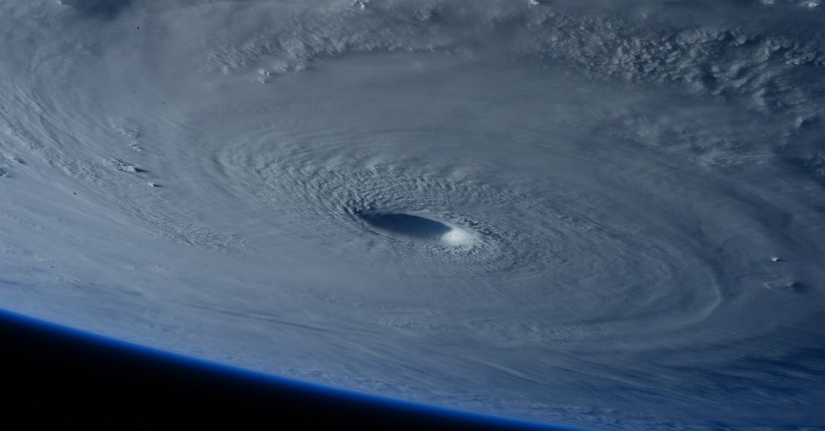
When Typhoon Noul tore across the South China Sea and slammed into Guangdong province on September 18, 2024, the question on every meteorologist’s mind wasn’t just how strong it was — it was how fast it got there. Noul underwent a period of rapid intensification that caught forecasters off guard, jumping from a tropical storm to a Category 2-equivalent typhoon in under 24 hours. That’s not just a curiosity; it’s a pattern that is becoming more common, and it carries serious implications for the 120 million people living in the Pearl River Delta.
Landfall near Yangjiang city brought sustained winds of 100 mph and torrential rain that dumped up to 12 inches in some areas within 48 hours. Authorities evacuated over 200,000 people, canceled hundreds of flights, and suspended ferry services across the region. But the real story of Typhoon Noul isn’t just the immediate damage — it’s what this storm says about a changing climate and a region that is urbanizing faster than its infrastructure can handle.
Rapid Intensification: The New Normal?
Typhoon Noul’s quick strengthening is part of a worrying trend. Warmer sea surface temperatures in the western Pacific — currently about 1.5°C above the 1991–2020 average — provide more fuel for storms. According to the Joint Typhoon Warning Center, Noul’s central pressure dropped by 30 millibars in the 12 hours before landfall, a classic signature of rapid intensification. Storms that do this are harder to forecast, and they leave communities with less time to prepare.
Compare that to Typhoon Hato in 2017, which also hit Guangdong but took a more predictable path and gave forecasters a full 48-hour lead. Hato caused $6.8 billion in damages. Noul’s track was more erratic, and while early estimates put economic losses at around $2 billion, the real cost could climb once agricultural damage from flooding is fully assessed. Rice paddies in the Leizhou Peninsula were submerged, and aquaculture farms along the coast suffered heavy losses.
This isn’t just a Chinese problem. Look at Hawaii, where Hurricane Fausto recently churned in the Pacific — a storm that also demanded attention beyond its immediate path because it hinted at the same mechanism: warm water, rapid intensification, and a coastline that isn’t built for it.
Flooding and Its Aftermath: Where the Water Goes
The immediate danger from Noul may have passed, but the floodwaters are still rising. Rivers in Guangxi and Hainan provinces have swelled beyond danger levels, and the risk of landslides remains high for days after the storm. In urban areas like Guangzhou and Shenzhen, drainage systems that were already strained by rapid development are now being tested to their limits.
Last year, New York City received a $43 million donation specifically for flood prevention — a recognition that even wealthy cities need to retrofit their infrastructure. Southern China, despite its economic boom, has a similar vulnerability. The difference is scale: the Pearl River Delta has more people and less time to adapt. When floodwaters recede, they often leave behind more than mud — they create stagnant pools that breed algae blooms, which can choke waterways and poison drinking supplies. The human cost of such blooms was documented in a recent report that described the aftermath as “like an amusement park chained shut” — a haunting reminder that the secondary effects of a storm can linger long after the winds die down.
Historical Comparisons: How Noul Stacks Up
Typhoon Noul isn’t the strongest storm to hit southern China — Typhoon Mangkhut in 2018 was a Category 5 beast that killed 134 people and caused $3.5 billion in damage. Noul is weaker, but it’s notable for its speed of development and the fact that it struck almost exactly two years after Typhoon Chanthu, which also underwent rapid intensification in the same region. That’s a clustering that statisticians are watching closely.
According to the China Meteorological Administration, the frequency of typhoons making landfall in China has not increased significantly, but the proportion of storms that reach Category 3 or higher has risen by about 15% since the 1980s. Noul fits that pattern. So does the broader shift: storms are carrying more water, moving slower once they hit land, and intensifying faster over warmer seas.
“The speed of Noul’s intensification was particularly alarming,” said a spokesperson from the CMA’s tropical cyclone research division. “We are seeing this more often now — storms that go from benign to dangerous in less than a day.”
For residents, the practical takeaway is clear: don’t rely on historical averages. A storm that looks weak on satellite imagery can turn into a major threat before you’ve finished taping the windows. Evacuation orders should be taken seriously even when the forecast seems uncertain.
What This Means for the Region and Beyond
Southern China’s economy is deeply tied to its ports, factories, and farms. Typhoon Noul disrupted shipping at the Port of Shenzhen for three days, which will ripple through global supply chains for electronics and apparel. The agricultural losses will push up vegetable prices in Guangzhou and Hong Kong for weeks. But the longer-term question is whether infrastructure can keep up.
China has invested heavily in flood control — the Three Gorges Dam and numerous river diversion projects have reduced the risk of catastrophic flooding in some areas. But local drainage in coastal cities remains a weak point. Storm surge barriers that work for Category 1 storms may not hold for a Category 2 that comes with a higher surge because of sea level rise. The latest reports from Reuters indicate that the Chinese government is already planning a new round of infrastructure upgrades, but the question is whether they can be built faster than the storms are arriving.
This isn’t just a story for China, either. The same ocean physics that supercharged Typhoon Noul also applies to hurricanes in the Atlantic and cyclones in the Indian Ocean. Every coastal city from Miami to Mumbai is facing a version of the same problem: warmer water, faster storms, and a race against time.
For now, the focus in southern China is on recovery. Emergency crews are clearing debris, restoring power, and distributing food and water to the hardest-hit areas. But the next storm is already forming in the Pacific. And if Typhoon Noul taught us anything, it’s that we can’t afford to look away.
Frequently Asked Questions
What made Typhoon Noul unusual?
Typhoon Noul underwent rapid intensification, strengthening from a tropical storm to a Category 2-equivalent typhoon in less than 24 hours. This rapid change made it harder to forecast and left less time for evacuations, highlighting a growing trend tied to warmer ocean temperatures.
How does Typhoon Noul compare to past storms in southern China?
While weaker than Typhoon Mangkhut (2018), Noul is notable for its speed of development and its timing — striking just two years after Typhoon Chanthu, which also intensified rapidly. The proportion of major typhoons hitting China has risen about 15% since the 1980s, making Noul part of a broader pattern.
What should residents do during the aftermath of a typhoon?
Even after the storm passes, floodwaters can cause landslides, contamination, and algae blooms. Residents should avoid walking or driving through floodwater, boil tap water if advised, and stay tuned to local authorities for updates on secondary hazards like disease outbreaks or infrastructure damage.