







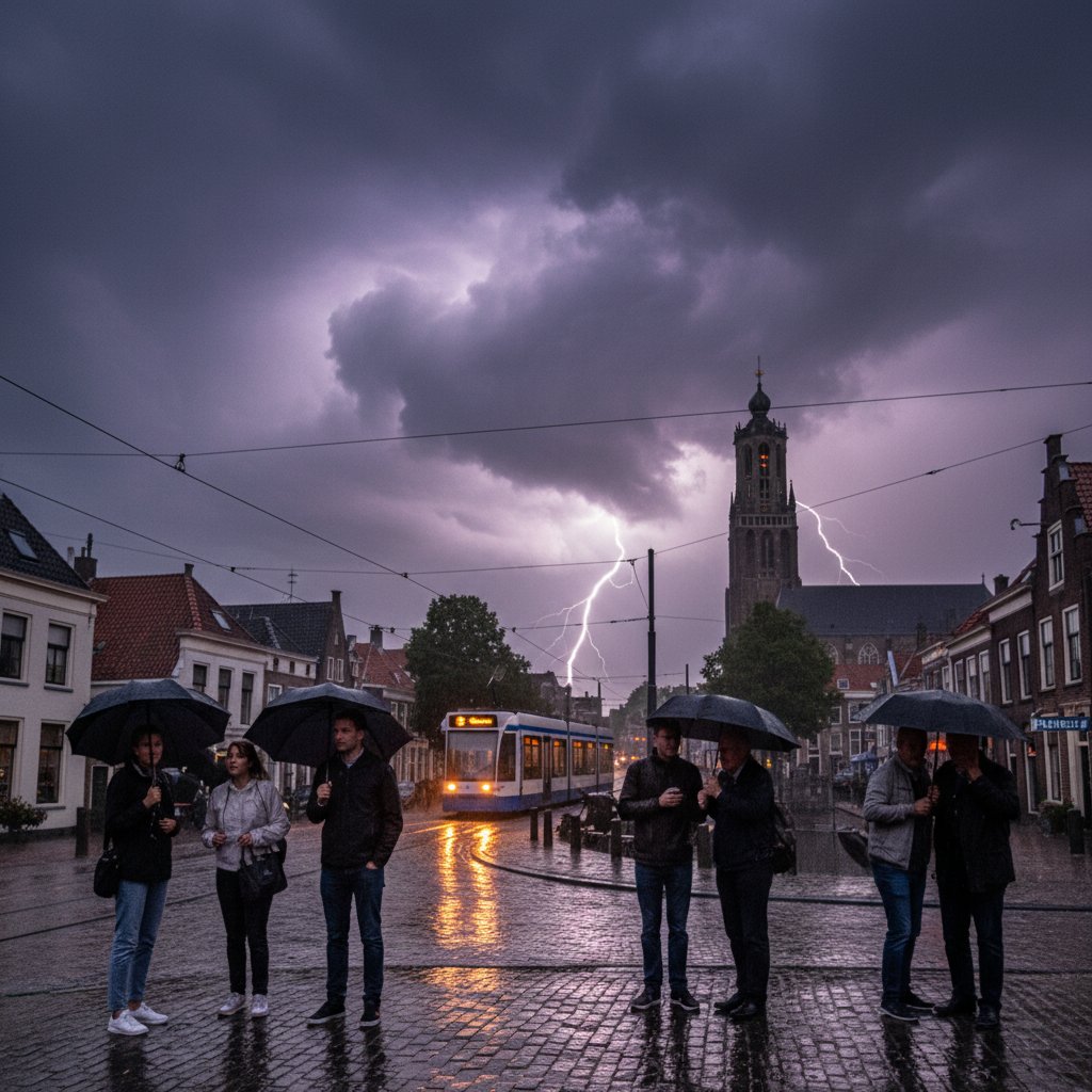
Let’s be honest: that thunderstorm over Delft wasn’t just a welcome relief from a week of suffocating heat. It was a barely disguised threat.
The storm that finally cracked the Dutch heat dome on July 19 brought more than rain and a drop in temperature. It brought a visceral reminder that extreme weather doesn’t come in neat, separate packages. Heatwaves and violent thunderstorms? They’re becoming a package deal. And Delft, the picturesque canal city known for its pottery and technical university, just got a front-row seat to the new normal.
The Suffocating Silence: A Week Under the Dutch Heat Dome
For seven days, the Netherlands had been baking. Temperatures in Delft hit 34.2°C on July 17—the hottest day of the year so far. The canals glowed like tea left too long in a pot. The cobblestones around the Oude Kerk radiated heat well past midnight. The Netherlands heatwave had gripped the country, breaking records in De Bilt and sending ambulance calls for dehydration soaring.
I spoke with Marieke van der Heijden, a local resident who runs a small bookshop on the Binnenwatersloot. “It was unbearable,” she told me. “I have asthma. The air sat on my chest like a stone. Every day I watched the sky for clouds that didn’t come.”
Heat domes happen when high pressure parks over a region, trapping hot air and suppressing convection. It’s the same mechanism that bakes the Pacific Northwest and, increasingly, western Europe. The KNMI—the Dutch meteorological institute—had issued a code orange for heat, warning of health risks and advising people to drink water and stay indoors. But for a city like Delft, where students cycle everywhere and canal boats are part of life, that advice felt like a prison sentence.
And then, on the afternoon of July 19, something shifted.
The Moment the Sky Broke Open Over Delft
The first sign wasn’t rain. It was sound. At 3:47 PM, a low rumble rolled across the Houtrust fields. Those who heard it stopped. They looked up. After a week of crystalline blue skies, a gray wall was advancing from the southwest. It looked like a curtain being pulled across the stage.
“I was in the TU Delft library when I heard the thunder,” said Erik van den Bergh, a meteorologist at the KNMI, who happened to be visiting his alma mater that afternoon. “It was unmistakable. The heat had been building all week, and the instability was off the charts. CAPE values—convective available potential energy—were over 3,000 J/kg. That’s rare for the Netherlands. When that cold front finally pushed in, it was like uncorking a bottle of champagne.”
The storm hit Delft like a freight train. Wind gusts of 85 km/h snapped tree branches on the Phoenixstraat. Rain fell at a rate of 18 mm in half an hour—enough to overwhelm the city’s drainage system within minutes. The Markt flooded ankle-deep, turning the square into a mirror reflecting the lightning bolts that split the sky.
Marieke van der Heijden was in her shop when the storm struck. “The lights flickered. I heard the crash—I thought it was the roof. But it was just the rain against the windows. I’ve never heard rain like that. It was like someone was throwing buckets of gravel.”
For a city that had been bone-dry for a week, the sudden flood was both a blessing and a menace.
More Than a Weather Event: What Thunderstorms After Heatwaves Mean
This wasn’t just a dramatic weather transition. It’s a signature of a warming climate. A study on heatwaves and thunderstorms published in Nature Climate Change in 2022 found that the probability of a strong thunderstorm following a heatwave in Europe has increased by 40% since the 1970s. The reason is simple: hotter air holds more moisture. When a cold front finally breaks the heat, all that latent energy gets released at once.
“Think of it as a tension-release mechanism,” said Dr. Femke de Jong, a climate researcher at Wageningen University. “The heatwave loads the atmosphere with energy and moisture. The cold front is the trigger. The result is often a severe thunderstorm with intense rainfall, hail, and strong winds. These are not isolated events—they are two sides of the same coin.”
For Delft, the implication is stark. The city sits on low-lying polder land, much of it below sea level. Its drainage system, designed for steady winter rainfall, was not built for these kinds of deluges. The storm flooded dozens of basements in the historic center. The TU Delft campus reported water damage in several laboratories. Emergency services were stretched thin.
The Dutch early warning system did buzz phones with a code yellow alert for thunderstorms about an hour before the storm hit. But many residents told me they didn’t see it until after the first lightning struck. This raises a question familiar to anyone who has read When the Sirens Sound: Inside America’s Tornado Warning System: How do you get people to act on a warning when they’ve been psychologically fried by a week of heat?
Erik van den Bergh acknowledged the challenge. “We issue warnings based on models. But human behavior is the hardest variable. After a heatwave, people are tired, they’re not thinking about thunder—they’re thinking about cold drinks and ice cream. That’s a gap we need to close.”
What Comes Next? The Storm’s Legacy
The rain stopped around 5 PM. The temperature dropped to 19°C—a full 15 degrees cooler than the day before. People emerged from their homes and shops, blinking in the soft evening light. The canals were higher than usual, swirling with leaves and debris. The smell of petrichor filled every street.
But the sense of relief was laced with unease. This was the first storm of this intensity to hit Delft in years. It won’t be the last. Climate models project that the transition from heatwave to thunderstorm will become more common across northwestern Europe. For Delft, a city that depends on precise water management, this means investing in infrastructure that can handle sudden flash floods—even after weeks of drought.
“We can’t keep treating these as one-off surprises,” Dr. de Jong said. “They’re part of a pattern. The city council should be looking at green roofs, permeable pavements, and expanded stormwater storage. Because next time, the rain might not stop after half an hour.”
Marieke van der Heijden is already thinking about what she’ll do differently. “I’m buying a sandbag for the shop door. And maybe a rain barrel. But really, I’m just grateful that the heat is gone. For now.”
The sky over Delft is clear again tonight. But everyone who felt that thunder rumble through the cobblestones knows: the weather is no longer something that just happens around you. It’s something that demands your attention. And your respect.
Frequently Asked Questions
Why do heatwaves often end with violent thunderstorms?
During a heatwave, the sun heats the ground intensely, which warms the air at the surface. Over several days, this builds up a lot of energy in the atmosphere, known as convective available potential energy (CAPE). At the same time, evaporation and transpiration add moisture. When a cold front or a trough finally arrives, it lifts the warm, moist air rapidly, triggering powerful thunderstorms. The longer and more intense the heatwave, the more fuel for the storm.
Is this thunderstorm in Delft related to climate change?
While no single storm can be directly attributed to climate change, the link between heatwaves and severe thunderstorms is becoming stronger in a warming world. Scientific studies have shown that the frequency of combined heatwave-thunderstorm events is increasing in Europe, particularly in low-lying areas like the Netherlands. Warmer air can hold more moisture—about 7% more for every degree Celsius—which intensifies rainfall when a storm finally breaks.
What should residents do when a thunderstorm follows a heatwave?
Pay attention to official weather warnings even if you’re exhausted from the heat. Before the storm hits, secure outdoor furniture, bring in pets, and ensure your phone receives emergency alerts. During the storm, avoid sheltering under trees near canals or open fields—lightning is a real danger. If flooding occurs, never walk or drive through flowing water; even a few inches can sweep you off your feet or stall a car. After the storm, check basements and drains for blockages, and watch for downed power lines.



