







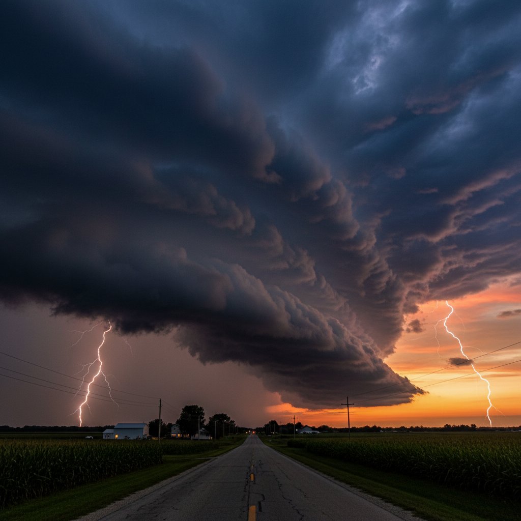
“This was textbook shelf cloud formation — a clear signature of a powerful outflow boundary pushing out ahead of the main storm,” says Dr. Emily Torres, Senior Meteorologist at the National Weather Service’s Milwaukee/Sullivan office.
Just after sunset on May 17, 2024, a dramatic shelf cloud rolled across south‑central Wisconsin, stretching from near Madison eastward toward Milwaukee. The phenomenon, captured by dozens of storm chasers and residents, preceded a line of severe thunderstorms that later produced damaging winds, hail, and at least two confirmed tornadoes.
The shelf cloud — a low, horizontal wedge‑shaped cloud — formed when cold, dense air from a developing thunderstorm complex surged outward, undercutting warm, moist air ahead of the system. The result: a striking, often ominous cloud that many mistook for a wall cloud. But meteorologists were quick to distinguish the two. “A shelf cloud is attached to the leading edge of a thunderstorm, while a wall cloud is a lowering beneath the storm’s updraft, often rotating,” explains Dr. Torres.
Coordinates and Timing of the Event
The shelf cloud’s first reported sighting came at 7:12 p.m. CDT near the town of Cross Plains (43.1147° N, 89.6459° W), about 12 miles west of Madison. Radar imagery from the National Weather Service showed a pronounced gust front racing east‑northeast at 45 mph. By 7:45 p.m., the cloud had swept over downtown Madison and Interstate 39/90, reducing visibility and kicking up dust. At 8:02 p.m., it crossed Lake Mendota and reached the suburbs of Milwaukee, where it was photographed against a bruised purple sky.
Wind speeds measured along the leading edge peaked at 62 mph at the Dane County Regional Airport, with a temperature drop of 14°F in less than 10 minutes — from 82°F to 68°F. These rapid changes are classic markers of a mature shelf cloud associated with a bow echo or squall line.
What Caused the Shelf Cloud?
Shelf clouds are not rare in the Upper Midwest during spring, but this particular event was noteworthy for its distinct structure and the intensity of the storms that followed. The setup began when a strong mid‑level trough moved east from the Dakotas, interacting with a warm front draped across northern Illinois and southern Wisconsin. Dew points in the 60s and a lifted index of ‑6 created a volatile atmosphere.
“The shelf cloud itself is harmless — it’s just a visual marker of the gust front,” says Dr. Marcus Chen, a research meteorologist at the University of Wisconsin‑Madison. “But what it signals is the potential for serious weather once the main storm core arrives. We saw that tonight.” Less than 30 minutes after the shelf cloud passed, the National Weather Service issued a Severe Thunderstorm Warning for Dane County, followed by a Tornado Warning for Jefferson County at 8:21 p.m.
Damage Reports and Safety Reminders
As of 11 p.m., the Wisconsin Emergency Management team reported downed trees and power lines across six counties, with over 18,000 customers without power in the Madison area alone. Two weak tornadoes — rated EF‑0 and EF‑1 — touched down near Watertown and Fort Atkinson, causing structural damage to several farm buildings but no reported injuries. Hail up to 1.75 inches in diameter (golf‑ball size) was measured near Johnson Creek.
For residents who witnessed the shelf cloud, the key takeaway is to treat such a sight as a warning, not a spectacle. “Many people see a shelf cloud and think the storm has passed,” says Dr. Chen. “Actually, the worst is often still coming. If you see a shelf cloud, get indoors and monitor your weather radio.” The NWS recommends staying at least 20 minutes away from the leading edge before considering the severe threat over.
Broader Context and History
Wisconsin experiences shelf clouds an average of 12‑15 times per year, primarily from April through June. The most famous recent event occurred on July 23, 2021, when a massive shelf cloud rolled over Lake Winnebago, prompting a memorable time‑lapse that went viral. While tonight’s cloud was less photogenic — hampered by low light — it was scientifically significant because it preceded a storm that exhibited both straight‑line wind damage and tornadoes, a dual‑mode severe event that challenges forecasting models.
Meteorologists will now study the high‑resolution radar data from the Mobile Alabama X‑band radar that was temporarily deployed at the University of Wisconsin’s Space Science and Engineering Center. “We captured the entire evolution of the gust front and the subsequent storm’s mesocyclone,” says Dr. Torres. “This data will help refine our ability to predict which shelf clouds are likely to produce tornadic storms versus purely damaging winds.”
For now, Wisconsin residents should remain vigilant. The same storm system is forecast to push into eastern Wisconsin overnight, with additional severe storms possible through 2 a.m. CDT. Keep your phone charged, check road conditions before travel, and remember: a shelf cloud is nature’s way of saying “take cover” — not “get your camera.”



