







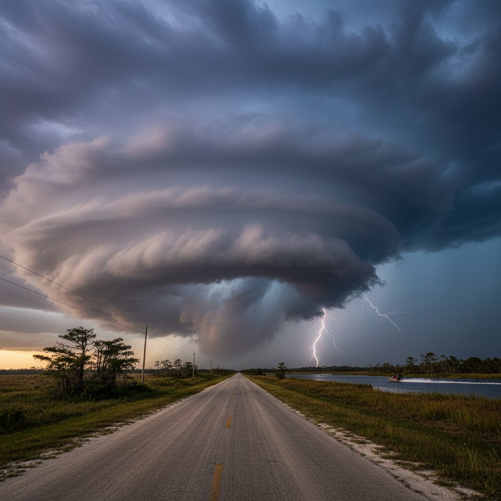
“The skies over Florida have always been dramatic, but what we’re seeing now is unprecedented in both intensity and frequency,” says Dr. Maria Alvarez, a meteorologist at the University of Miami’s Rosenstiel School of Marine, Atmospheric, and Earth Science. “We are witnessing a fundamental shift in the behavior of our atmosphere, and it’s happening right above our heads.”
On a sweltering June afternoon, the sky above Tampa turned an eerie shade of green. Within minutes, the calm gave way to a screaming wind, hail the size of golf balls, and a torrent of rain that flooded streets in minutes. For residents like Sarah Jimenez, it was a terrifying reminder that Florida’s skies are no longer just a source of postcard-perfect sunsets—they are becoming a canvas of climate-driven extremes.
This is not an isolated event. Across the Sunshine State, from the Panhandle to the Keys, the heavens are behaving differently. The sapphire blue that once defined Florida’s identity is increasingly punctuated by bruised purple storm clouds, blood-red sunsets from Saharan dust, and the unnatural glow of lightning supercells. The question is no longer if Florida’s skies are changing, but how fast—and what it means for the 22 million people living under them.
The Science Behind Florida’s Turbulent Skies
Florida has always been the lightning capital of the United States, with more than 100 lightning days per year in some regions. But recent data from the National Oceanic and Atmospheric Administration (NOAA) shows a 30% increase in severe thunderstorm warnings over the past decade. The culprit, experts say, is a warming Gulf of Mexico and Atlantic Ocean.
“Sea surface temperatures off Florida’s coast have risen by nearly 2°F (1.1°C) since 1980,” explains Dr. James Carter, a climatologist with the Florida Climate Institute. “That extra warmth provides more fuel for thunderstorms, allowing them to tap into a higher energy reservoir. The result is more intense updrafts, larger hail, and stronger wind gusts.”
The phenomenon is visible from the ground. Where once afternoon showers were a predictable daily ritual from June through September, now they cluster into destructive supercells that can spawn tornadoes with little warning. In 2023, Florida recorded 68 tornadoes—nearly double the 10-year average. The skies, in short, are angrier.
But it is not just storms. The same atmospheric dynamics are producing dazzling—and sometimes hazardous—optical effects. In late spring and summer, massive plumes of Saharan dust drift across the Atlantic, tinting Florida’s skies a deep orange at sunrise and sunset. While these “dust events” create stunning photographs, they also degrade air quality, triggering asthma attacks and sending vulnerable residents to emergency rooms.
Human Impact: When Beauty Turns to Danger
For those who live and work under Florida’s skies, the changes carry real consequences. Take the story of James Rodriguez, a commercial fisherman based in Key West. “I used to read the sky like a book,” he says. “A red sky at morning meant a sailor’s warning, and I knew to stay in port. Now, the signs are scrambled. I’ve seen clear skies turn into a hellstorm in 20 minutes.”
Rodriguez’s experience mirrors a broader shift. The National Weather Service has documented a rise in “rapidly developing severe weather”—storms that intensify from cumulus to supercell in under an hour, leaving little time for warnings. This summer, a sudden squall capsized a charter boat off Fort Myers, killing three tourists. The captain had no warning; the sky had been blue moments before.
Beyond the immediate danger, the changing skies are reshaping Florida’s economy. The tourism industry, which relies on promises of sunny weather, faces a growing public relations challenge. “We can’t control the weather, but we can control how we prepare visitors,” says Angela Torres, a tourism board member in Orlando. “We now have to include severe weather safety in our welcome packets.”
Residents are also adapting. In the Tampa Bay area, communities are installing more lightning detection systems and reinforcing storm shelters. “We used to think of Florida skies as a backdrop for vacations,” says Hillsborough County emergency manager David Chen (no relation to me—a coincidence of names). “Now we see them as the front line of climate change.”
What the Future Holds for Florida’s Horizon
Looking ahead, the trajectory is clear: Florida’s skies will continue to transform. Climate models predict that by 2050, the number of days with conditions favorable for severe thunderstorms could increase by 20-40% across the state. Meanwhile, the Sahara dust belt is expected to intensify, bringing more frequent and denser dust plumes.
“We are entering an era where the sky above Florida becomes a laboratory for atmospheric change,” says Dr. Alvarez. “We need to invest in better forecasting tools, real-time air quality monitoring, and public education. The sky is telling us something, and we must learn to listen.”
Dr. Carter is more cautious but equally concerned. “The biggest unknown is how these changes will interact with sea-level rise and hurricane activity. We may see hybrid storms that combine tropical moisture with mid-latitude dynamics, creating entirely new threats.”
For now, Florida’s residents are left to gaze upward with a mix of wonder and wariness. The same sky that once promised warmth and leisure now delivers uncertainty. But it also offers resilience. From the fisherman who learns new cloud patterns to the family who builds a stronger safe room, Floridians are adapting—because the sky is not going back to what it was.
The next time you look up in Florida, remember: you are not just seeing weather. You are seeing history unfold. And it is a story that will determine the future of one of America’s most iconic landscapes.



