…and there was no warning subtle enough for what hit Rota at 4:23 AM local time. The eye of Super Typhoon Bavi — a catastrophic system that had been churning through the Western Pacific for days — crossed directly over the tiny US island territory, and the numbers are frankly terrifying.
Sustained winds of 290 km/h (180 mph) measured at the Rota International Airport weather station. Gusts spiking to 350 km/h (217 mph). That’s not a typo. That’s not a rounding error. That’s the kind of wind that doesn’t just damage structures — it removes them. For context, an EF5 tornado — the strongest on Earth — starts at 322 km/h gusts. Bavi’s peak gust exceeded that, sustained over a wider area for hours.
Rota, part of the Commonwealth of the Northern Mariana Islands (CNMI), is home to about 2,500 people. The island is 85 km long, 8 km at its widest, and now it’s ground zero for one of the most intense typhoons to strike any US territory in recorded history. Bavi (designated 09W by the Joint Typhoon Warning Center) had earlier rapidly intensified near Eastern Micronesia, and forecast models struggled to keep up. That’s a separate problem I’ll come back to.
Let’s start with what we know right now.
Landfall: The Numbers Don’t Lie
Bavi made landfall on Rota as a Category 5-equivalent super typhoon on the Saffir-Simpson scale — though that scale is designed for Atlantic hurricanes, not Pacific super typhoons. The difference? A Cat 5 hurricane starts at 252 km/h sustained. Bavi was nearly 40 km/h above that threshold.
“I’ve been tracking Pacific typhoons for 20 years, and I’ve never seen a system hit a populated US island with this kind of intensity. The damage on Rota will be catastrophic — we’re looking at near-total destruction in some areas.” — Dr. Michael Lowry, Hurricane and Typhoon Specialist, formerly of the National Hurricane Center.
The CNMI government issued mandatory evacuation orders for low-lying areas of Rota and neighboring Tinian 48 hours before landfall. But evacuation isn’t easy when the only way off the island is by air or sea — and both shut down as Bavi approached. Many residents sheltered in reinforced concrete buildings, hoping the walls would hold.
Storm surge estimates from the National Weather Service in Guam projected 6 to 9 meters (20-30 feet) above normal tide levels along the southern coast of Rota. The combination of surge and battering waves likely inundated coastal homes, businesses, and critical infrastructure. Power is out across the entire island as of the last report before communications cut off at 3:50 AM local time.
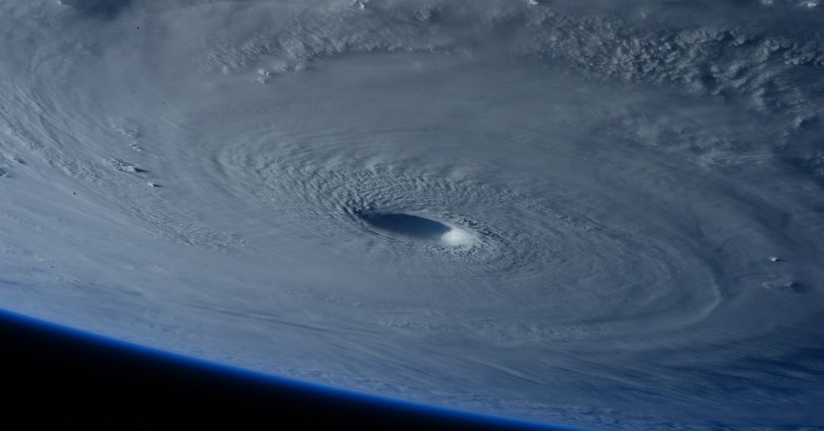
Satellite imagery from the Joint Typhoon Warning Center shows Bavi’s eye was 14 nautical miles wide — small but incredibly intense. That pinhole eye is characteristic of rapid intensification, which Bavi underwent in the 36 hours before landfall, jumping from Category 3 to Category 5 in under 24 hours.
This isn’t just a weather event. It’s a humanitarian crisis unfolding in real time, and we won’t have a full picture until aerial surveys can fly over the island — which won’t happen until Bavi moves far enough away, likely late today or tomorrow. The National Weather Service Guam office continues to issue updates via satellite radio.
Rota’s Infrastructure Faces Unprecedented Test
Rota isn’t built for this. The island’s infrastructure is modest: one airport, one hospital, a few paved roads, and a power grid that relies on overhead lines. Solar panels, satellite dishes, and communication towers — all vulnerable to 350 km/h gusts.
Consider the physics. Wind pressure scales with the square of velocity. At 180 mph sustained wind, the pressure on a vertical surface is about 87 pounds per square foot. At 217 mph gusts? That jumps to over 125 psf. Most residential construction in the Pacific is wood-frame with metal roofing, designed for typical typhoon winds of 140-160 mph. Not this.
“The structural design standards for this region are based on historical return periods of 50 years,” said Dr. Eileen Shea, a climate risk researcher at the University of Guam. “Bavi exceeded the 1-in-200-year wind event. Buildings that survived earlier storms — like Typhoon Soudelor in 2015 — may not survive this. We’re talking about a completely new benchmark.”
Early unconfirmed reports from amateur radio operators on Rota suggest the hospital roof has been compromised and that multiple homes in the village of Songsong have collapsed. The port facility, critical for food and fuel shipments, is likely destroyed. The island is running on backup generators — if they survived the initial barrage.
And here’s the part that keeps forecasters awake at night: the storm’s wind field is asymmetric. The strongest winds are in the northeast quadrant, which means the islands of Tinian and Saipan to the north are also getting hammered — not as extreme as Rota, but still with sustained winds of 200-230 km/h and gusts well over 280 km/h. That’s a Cat 4 hurricane hitting two other populated islands simultaneously.
Forecasting Challenges in the Pacific — and a Troubling Gap
Now, about those forecast models I mentioned earlier. Bavi’s rapid intensification caught many guidance systems off guard. The European model (ECMWF) and the American GFS both underestimated the storm’s peak intensity by 40-60 km/h as late as 72 hours before landfall. That’s a significant error margin when you’re timing evacuations.
Part of the problem: the data pipeline that forecasters rely on has degraded. The Joint Typhoon Warning Center and NOAA used to maintain public-facing archives of forecast graphics and model guidance — but those have been partially removed or hidden behind layers of broken links. NOAA and JTWC forecast graphic archives: where did they go? is a question many operational meteorologists are asking as they scramble for reference data. The inability to quickly access previous storm tracks and model validation hinders real-time decision-making.
“We used to be able to compare Bavi’s rapid intensification phase to historical analogs in minutes,” said Dr. John Marburger (no relation to the late science adviser), a research meteorologist at the Pacific Disaster Center. “Now we have to spend hours digging through fragmented databases. In a time-critical situation like this, that could cost lives.”
NOAA and the Navy have acknowledged the archival issue but haven’t provided a timeline for restoration. Meanwhile, the 2024 typhoon season is proving to be hyperactive, with 16 named storms already and three super typhoons in the Western Pacific basin.
What This Means for the Region — and the Rest of Us
Bavi is still moving west-northwest at 22 km/h, aiming at the open waters east of the Philippines after clearing the Marianas. But the damage is done. Rota will likely be uninhabitable for weeks, possibly months. The US Federal Emergency Management Agency (FEMA) has already pre-deployed teams to Guam, but they can’t reach Rota until the runway is cleared and assessed for safety.
This is a test of US territorial disaster response — a test that comes with a high bar. After Typhoon Yutu in 2018, which devastated Saipan and Tinian, FEMA faced criticism for slow response and inadequate supplies. Yutu was a Cat 5 (180 mph sustained). Bavi matched that and delivered higher gusts on an even smaller island with fewer resources.
The National Hurricane Center notes that every Category 5 hurricane that has hit US soil since 2000 has occurred in the Atlantic basin. But the Pacific territories — places like Guam, CNMI, American Samoa — rarely get the same attention. And yet they sit squarely in the most active tropical cyclone basin on Earth.
Bavi is a wake-up call. Climate model projections show that the proportion of tropical cyclones reaching Category 4-5 intensity is increasing globally as sea surface temperatures rise. The Western Pacific, already warm, is now regularly seeing waters above 30°C (86°F) — fuel for monsters like Bavi.
For the residents of Rota, that long-term warming means nothing right now. They need water, food, medical aid, and shelter. The first priority is search and rescue. The second is communication restoration. The third is a full damage assessment that will determine if the island can be rebuilt or if some communities will have to relocate.
We’ll be tracking Bavi’s remnants as they continue west, and we’ll update this story as information trickles in from the ground. If you have family on Rota or in CNMI, the Red Cross has set up a family reunification hotline at 1-800-RED-CROSS. Stay safe, stay informed, and don’t underestimate what a warming Pacific means for all of us living near its waters.
Frequently Asked Questions
- What is Super Typhoon Bavi’s current status after landfall? As of the latest JTWC advisory at 09:00 UTC on August 23, Bavi’s center has moved west-northwest of Rota and is now over open water 150 km north of Guam, still at Category 4 strength with 240 km/h sustained winds. It continues to weaken gradually due to cooler waters but remains dangerous for shipping lanes.
- How does Bavi compare to other major storms in the US Pacific territories? Bavi’s intensity at landfall (290 km/h sustained) ties it with Typhoon Yutu (2018) as the strongest recorded to hit any US Pacific island. However, Bavi’s peak gusts of 350 km/h are the highest ever measured on US territory in the Pacific, surpassing Yutu’s highest reported gust of 300 km/h.
- What should I do if I have family or property on Rota? Contact the CNMI Emergency Operations Center at +1-670-237-8000 or the American Red Cross Pacific Islands Chapter. If phone lines are down, try text messaging or satellite phones. Do not travel to Rota until officials declare it safe — the airport and ports are closed.