







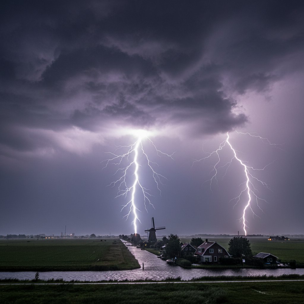
The skies above the Netherlands erupted on June 28, 2026, in what meteorologists are calling the most intense lightning storm in European history. Over 100,000 cloud-to-ground strikes hit in just six hours, triggering wildfires, power outages, and a public health crisis. The storm, which began at 8:00 PM local time, turned the night sky into a strobe light—a dazzling, terrifying spectacle that left millions scrambling for cover. For those with photosensitive epilepsy, it was a nightmare: emergency services reported a 400% spike in seizure-related calls.
This wasn’t just a thunderstorm. It was a meteorological anomaly. The Dutch weather service KNMI recorded an average of 17 strikes per second at the storm’s peak—comparable to the most active parts of a supercell in the American Plains. But the Netherlands isn’t Oklahoma. The country’s flat, densely populated landscape meant that every strike hit close to homes, farms, and infrastructure. And the numbers are staggering: lightning ignited at least 12 fires, including a major blaze at a chemical plant in Rotterdam, which forced the evacuation of 3,000 residents. A high-speed train near Amsterdam was struck, shutting down rail service for hours. One farmer near Utrecht lost 40 cows to a single ground strike.
Why So Many Strikes? The Atmospheric Setup
Meteorologists point to a rare combination of factors. A plume of Saharan dust had drifted over Western Europe earlier that week, supercharging the atmosphere with particles that act as nuclei for ice crystals—and lightning requires ice. Normally, the Netherlands gets about 25 to 30 thunderstorm days per year, with an average of 100,000 strikes in an entire year. This storm delivered that annual total in a single evening.
“We’ve seen similar patterns before—most notably during the 2010-2011 Queensland floods in Australia, where lightning activity exploded due to increased surface temperatures and moisture,” says Dr. Helena Voss, a lightning researcher at the University of Leeds. “But this is the first time we’ve documented such an event in a northern European coastal region. The North Sea was unusually warm—about 3°C above average—which fueled the updrafts.” A study from the Royal Netherlands Meteorological Institute (KNMI) confirmed that sea surface temperatures in June 2026 were the warmest on record for that month.
“The energy density of this storm rivaled the most prolific lightning producers on Earth, like the Catatumbo lightning in Venezuela,” said Dr. Voss. “But Catatumbo happens over a remote lake. This happened over a country with 17 million people.”
And the timing couldn’t have been worse. The storm hit during the [FIFA World Cup 2026](https://cyclonepost.com/fifa-world-cup-2026-bracket-48-teams-104-matches-one-unprecedented-tournament/)—many people were outside watching matches at public viewing parties in Amsterdam, Utrecht, and The Hague. Outdoor screens were abruptly shut down as lightning threatened crowds. One person was injured by a direct strike in a park in Eindhoven, where a group had gathered around a portable TV.
Chaos on the Ground: Emergency Response and Aftermath
The Dutch emergency services—usually drill-perfect for floods—were caught off guard. “We have protocols for water; we don’t have protocols for a lightning siege,” said a spokesperson for the National Crisis Center. Hospitals reported that emergency departments were overwhelmed not just by seizure patients but also by people struck by lightning (28 confirmed injuries) and those with blast-related trauma from nearby strikes. One woman in The Hague suffered a cardiac arrest from a strike that hit her garden shed; she survived thanks to a neighbor who performed CPR.
Meanwhile, the country’s power grid took a beating. TenneT, the transmission operator, reported that 14 high-voltage pylons were damaged, leaving 200,000 households without electricity for up to 12 hours. The damage was eerily reminiscent of the 2021 summer storm that knocked out power across Limburg—but this time, the culprit wasn’t wind, it was electricity itself. “We had to shut down sections of the grid to prevent cascading failures,” said TenneT engineer Mark van Dijk. “It’s like tripping a breaker inside your house, except the breaker is the size of a city.”
Authorities issued a “stay indoors” order for the western provinces between 9 PM and 2 AM, but many didn’t receive it. The KNMI’s website crashed under traffic, much like the NWS website down at 0945 EDT earlier this month during a severe weather outbreak in the US. The outage delayed warnings and frustrated residents who turned to social media for updates—only to find rumors spreading faster than the storm itself.
A Broader Pattern: Lightning and Climate Change
This storm feeds into a growing body of research linking lightning frequency to global warming. A 2023 study from the University of California, Berkeley, projected that lightning strikes in the continental US could increase by 12% for every degree Celsius of warming. Europe isn’t immune. “We’re seeing more of these high-shear, high-CAPE environments in places that historically didn’t get them,” says Dr. Voss. “The Netherlands is becoming a case study.”
But climate anxiety isn’t just about the physical damage. The psychological toll is real. Mass trauma from extreme weather events is a recognized phenomenon, and lightning storms—sudden, violent, and visually overwhelming—can trigger lasting fear. As mental health advocates like Selena Gomez have highlighted, climate anxiety is a growing crisis, especially for younger generations. Dutch hotlines saw a 150% increase in calls about weather-related fear in the 72 hours after the storm, according to the mental health organization MIND.
What does this mean for the average reader in the US or UK? If you live in a region that doesn’t usually get frequent lightning, don’t assume you’re safe. The same warm ocean waters that fueled this Dutch storm are now heating the Atlantic and the North Sea. Coastal cities could see more “lightning bombs” in the coming decades. The KNMI is already discussing upgrades to its lightning detection network—but that’s a reactive measure. The proactive question is: can we even predict when the atmosphere will turn into a Van de Graaff generator?
For now, the Netherlands is cleaning up. Farmers are assessing herd losses. Insurers are tallying claims—expected to exceed €500 million. And sky-watchers are left with a lingering sense of awe and dread. Because what happened on June 28 wasn’t just a storm. It was a preview.
Next year, it could be your city.
Frequently Asked Questions
The storm was fueled by unusually warm North Sea waters (3°C above average) and a plume of Saharan dust that provided nuclei for ice crystal formation. The combination of high humidity, strong updrafts, and abundant surface heat created conditions similar to those in tropical thunderstorm complexes—but over a densely populated country.
During an extreme lightning event like this, it’s safest to unplug sensitive electronics and avoid using corded devices. Lightning can surge through power lines and damage equipment miles away. The Dutch storm caused power fluctuations that fried thousands of home appliances. If you’re in a lightning-prone area, consider installing surge protectors at your main breaker panel.
Warmer air holds more moisture, and that extra moisture fuels stronger updrafts in thunderstorms. More updrafts mean more ice particles colliding, which generates more electrical charge. Scientific models predict a 10–15% increase in lightning strikes for every 1°C rise in global average temperature. The Netherlands storm aligns with these projections, though attribution studies are still ongoing.



