







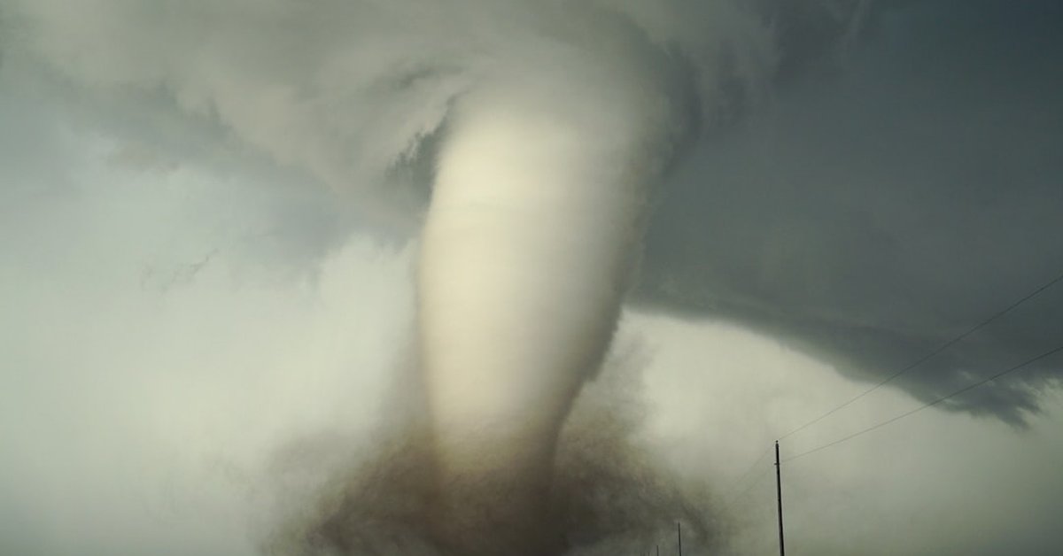
You picture Myrtle Beach and you think of lazy waves, hot sand, and the smell of boardwalk popcorn. What you don’t picture is a massive tornado churning in from the ocean, ripping through hotels and flipping cars like toys. But twenty-five years ago, that’s exactly what happened.
On August 6, 1999, a powerful waterspout moved ashore near the heart of South Carolina’s Grand Strand, catching tens of thousands of tourists completely off guard. It killed two people, injured dozens, and left a scar that the city still carries—even if most visitors have forgotten.
“We saw it coming across the water, but nobody thought it would actually hit land,” recalls Linda Garvey, who was vacationing from Ohio with her family that afternoon. “People were just standing on the beach taking pictures. Then all hell broke loose.”
The tornado was rated F2 on the Fujita scale, with winds estimated between 113 and 157 mph. It carved a path nearly a mile long and up to 200 yards wide, tearing through the Ocean Drive section of North Myrtle Beach before weakening over the Intracoastal Waterway. The National Weather Service office in Wilmington, North Carolina later documented that the tornado formed from a supercell thunderstorm that had developed over the warm Atlantic waters—a relatively rare setup for the Carolina coast.
From Waterspout to Killer Tornado
Waterspouts are common off the Southeast coast, especially in late summer. Most of them fizzle out before they ever touch land. But this one didn’t. It strengthened as it moved over the beach, sucking up sand and debris, turning a perfect summer day into a horror scene.
“What made this event so dangerous was the surprise factor,” says Dr. Margaret Chen, a meteorologist and tornado researcher at the University of South Carolina. “People at the beach aren’t thinking about tornadoes. They’re thinking about sunscreen and where to get dinner. There was no warning—the technology then just couldn’t see it coming fast enough.”
Indeed, in 1999, Doppler radar coverage along the coast was spottier than it is today. The storm produced a tornado warning only minutes before it hit. Many people never heard it.
The aftermath was chaotic. Emergency responders found overturned vehicles, collapsed roofs, and debris scattered across several blocks. Awnings ripped from storefronts. A beachfront hotel lost its entire front facade. Two people died: a tourist from Canada who was struck by flying glass, and a local man who was crushed when his mobile home rolled into a ditch.
“I remember the sirens going off after it was already over,” says Mike Patterson, a retired firefighter who responded to the scene. “We just went from building to building, pulling people out. It was surreal—sand everywhere, like the beach had come inland and brought the storm with it.”
Twenty-five years later, the question is: could it happen again? Absolutely. In fact, when’s the last time Earth saw conditions like this? The answer, according to climate researchers, is right now. Warmer sea surface temperatures fuel stronger thunderstorms, and the Gulf Stream off the Carolinas is running hotter than it was a quarter-century ago.
A Coastline That’s Grown—and Grown Vulnerable
Since 1999, Myrtle Beach has exploded. The population of Horry County has nearly doubled. High-rise condos and hotels now line miles of shoreline where empty lots once stood. More people means more potential targets when a tornado rolls ashore.
“The risk is actually higher today because of exposure,” explains Dr. Chen. “Even if the frequency of tornadoes hasn’t changed dramatically, the number of structures and people in the danger zone has skyrocketed.”
Yet awareness remains low. Beach towns market sun and fun, not storm safety. Many visitors don’t even realize that South Carolina averages 11 tornadoes per year, and that coastal tornadoes—though less common than inland ones—tend to be fast-moving and difficult to forecast because they develop over water.
The 1999 Myrtle Beach tornado was part of a larger outbreak that produced at least 13 tornadoes across the Carolinas that day, including an F3 that killed one person in Conway. The National Weather Service’s official report on the event remains a case study in coastal tornado preparedness—or the lack thereof.
Since then, radar coverage has improved, and the NWS now issues “waterspout warnings” for some coastal areas. But the fundamental challenge remains: a tornado can form in minutes over the ocean, and by the time it reaches the beach, there’s little time to react.
“You have to have a plan,” says Patterson. “If you’re renting a beach house, look at where you’d go if a tornado warning came. Most of those rentals don’t have basements. Know the nearest interior room. Don’t just assume it’ll never happen.”
What the Memory of 1999 Means Now
For locals, the anniversary brings back a mix of sadness and gratitude. No major tornado has hit the Grand Strand head-on since then—though waterspouts come ashore every few years, and in 2019 a weak tornado touched down in Surfside Beach without causing injuries.
But the quiet stretch has bred complacency. Among the thousands of tourists flooding Myrtle Beach this August, only a handful likely know about the 1999 storm. The boardwalk has been rebuilt. The hotels have been renovated. The scars are invisible—unless you know where to look.
“I think we forget that nature doesn’t care about our vacation plans,” says Dr. Chen. “The atmosphere is getting more energetic. We need to take that seriously.”
As for the broader context of extreme weather, it’s worth remembering that the same atmospheric dynamics that spawned the Myrtle Beach tornado also drive larger systems around the globe. While the Northeast deals with record rainfall—Northern Illinois drenched: July 2–4 rainfall totals shatter records—coastal communities face their own unique threats from the sea. Not just hurricanes, not just storm surge, but tornadoes, too.
Looking forward, researchers are studying whether a warming climate will increase the frequency of waterspout-to-tornado transitions along the U.S. East Coast. Early data suggests it’s possible. The ingredients—warm water, instability, wind shear—are all projected to become more common in late summer.
So next time you’re standing on a Myrtle Beach balcony watching a dark cloud form over the Atlantic, don’t just grab your camera. Grab your keys and head inside. The ocean can be beautiful. It can also be deadly. And sometimes, it doesn’t give you much warning.
Frequently Asked Questions
How common are tornadoes in Myrtle Beach?
Tornadoes in Myrtle Beach are rare but not unprecedented. The area averages about 1-2 tornado touchdowns per decade, most of them weak (EF0-EF1). The 1999 F2 tornado is the strongest to directly hit the beach in modern records. However, waterspouts that move ashore occur more frequently, roughly every 2-3 years.
Can a tornado form over the ocean and move onto land?
Yes. When a waterspout forms from a supercell thunderstorm (rather than from fair-weather cumulus), it can be just as dangerous as a land tornado. These are called “tornadic waterspouts.” They can intensify as they move over land because they draw in warm, moist air from the ocean and encounter friction from buildings and trees, which can enhance rotation.
What should I do if I see a waterspout while at the beach?
If you see a waterspout—especially one associated with a thunderstorm—do not wait. Move inland immediately. Get inside a sturdy building on the lowest floor, away from windows. Do not stay on the beach or in a vehicle. If you’re in a high-rise hotel, go to an interior hallway or stairwell. Most deaths from coastal tornadoes occur when people are caught in open areas or vehicles.



