When Hurricane Milton slammed into Florida’s Gulf Coast last October, a single image from inside its eye captured global attention. A nearly vertical wall of clouds, illuminated by a shaft of sunlight, created an illusion of a vast, cylindrical amphitheater. The question spread across social media: What is this?
The answer is the “stadium effect” — a rare visual phenomenon that occurs only under specific conditions inside the strongest hurricanes. But for meteorologists, it is more than just a stunning photograph. It is a telltale sign of rapid intensification, a trend that is becoming more common in a warming climate.
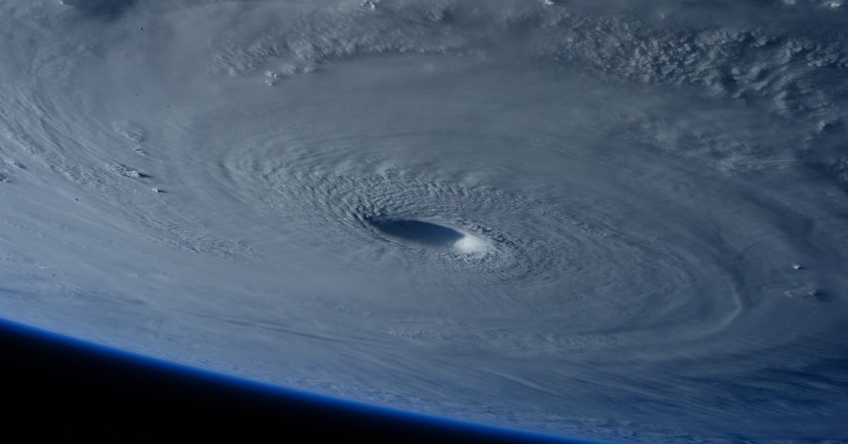
On October 9, 2024, Hurricane Milton made landfall near Siesta Key, Florida, as a Category 3 storm. But just 24 hours earlier, it had been a ferocious Category 5, with sustained winds of 180 mph. During that peak, an NOAA reconnaissance aircraft flew into the eye and captured video that showed the stadium effect in vivid detail. The footage quickly went viral, generating millions of views and the inevitable refrain: “What is this?”
The Science Behind the Stadium Effect
The stadium effect, also known as the “stadium phenomenon,” occurs when the eyewall clouds slope outward at a steep angle, creating a concave shape that resembles a sports arena. Sunlight entering from above illuminates the clouds, accentuating the effect. It is not visible from the ground — only from inside the eye, typically from a research aircraft or, in rare cases, from the International Space Station.
Dr. Kristen Corbosiero, a professor of atmospheric science at the University at Albany, explains: “The stadium effect requires an extremely symmetrical, well-defined eyewall with very steep vertical development. It’s a signature of a mature, intense hurricane that has undergone rapid intensification. You almost never see it in weaker storms.”
The effect is linked to the storm’s internal dynamics. As a hurricane intensifies, the eyewall contracts and the strongest winds tighten around the center. This process often produces a “vertical hot tower” — a deep column of thunderstorm clouds that punches into the stratosphere. The sides of these towers, when illuminated, create the stadium illusion.
Historical examples are rare. Hurricane Allen (1980) and Hurricane Isabel (2003) both displayed the effect during their peak intensities. But the clearest imagery came from Hurricane Patricia in 2015, the strongest hurricane ever recorded in the Western Hemisphere, which exhibited a textbook stadium effect. Milton’s video, however, was the first to go viral in the age of social media, sparking widespread curiosity.
“It’s one of those things that reminds you how powerful and beautiful these storms can be,” says Dr. Corbosiero. “But the beauty is a warning: the storm is at its most dangerous.”
Why It Matters: A Climate Connection
The stadium effect is not just a visual novelty. Its increasing frequency — or at least, its more frequent documentation — is tied to a broader trend. Hurricanes are intensifying more rapidly than they did decades ago, and the conditions that produce the stadium effect are exactly those that lead to rapid intensification.
Data from the National Hurricane Center shows that between 1990 and 2024, the number of Atlantic hurricanes that underwent rapid intensification (defined as a wind speed increase of 35 mph or more in 24 hours) rose by about 25%. Warmer sea-surface temperatures, which are directly linked to human-caused climate change, provide the fuel for such explosive growth.
Dr. James Kossin, a climate scientist and hurricane expert formerly with NOAA, notes: “The stadium effect is a visible manifestation of the thermodynamic engine at work. When you see it, you know the ocean is exceptionally warm and the atmosphere is primed for the storm to tap into that energy. In a warming world, we should expect to see more of these extreme structures.”
Milton’s rapid intensification was fueled by sea-surface temperatures in the Gulf of Mexico that were 2–3°F above the 1991–2020 average. That extra heat allowed the storm to go from a tropical storm to a Category 5 in just 36 hours. The stadium effect appeared during that window.
What It Means for Forecasters and the Public
For hurricane forecasters, the presence of a stadium effect in satellite or aircraft imagery is a red flag. It signals that the storm may be near its maximum potential intensity, and any further warming of the ocean could lead to even more extreme winds. Yet the phenomenon also highlights a gap between what scientists observe and what the public understands.
When the Milton video surfaced, many viewers assumed it was CGI or a hoax. Dr. Corbosiero spent hours debunking misinformation. “The public is not used to seeing the inside of a hurricane eye in such clarity. The stadium effect looks surreal, but it’s real — and it’s a sign that the storm is dangerous.”
For residents in hurricane-prone areas, the key takeaway is urgency. A storm that shows a stadium effect is a storm that has likely undergone rapid intensification. That means winds can jump from a Category 1 to a Category 4 faster than evacuation timelines can adjust.
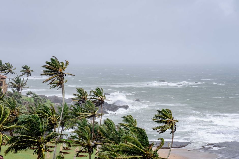
In Milton’s case, the stadium effect was observed when the storm was still far from land. But forecasters struggled to communicate the risk because the storm weakened slightly before landfall. Some residents chose not to evacuate, assuming the earlier warnings were exaggerated. The result: at least 24 deaths and billions of dollars in damage.
Looking Ahead: The New Normal?
As ocean temperatures continue to rise, the conditions that produce the stadium effect will become more common. Already, researchers are using machine learning to detect the phenomenon in satellite imagery automatically — not for the spectacle, but as a real-time flag for rapid intensification.
Dr. Kossin warns: “We may reach a point where the stadium effect is no longer a rare curiosity but a routine warning. That would be a troubling milestone for the climate.”
For now, the viral question — “What is this?” — serves as a teachable moment. The answer is equal parts science, beauty, and danger. The next time you see a stadium effect, remember: it is nature’s way of showing you a hurricane at its most powerful. And in a warming world, we will likely see it again — sooner than we think.