







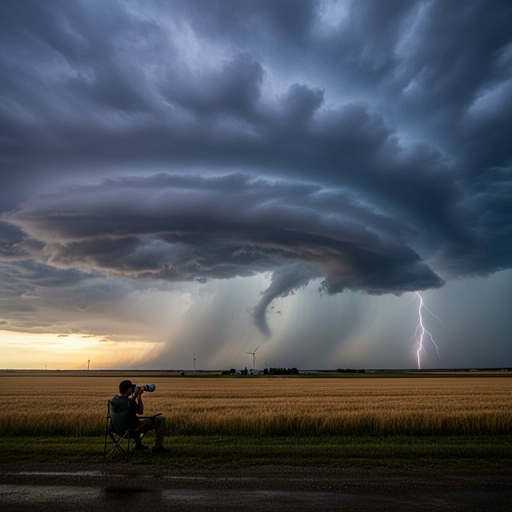
As severe thunderstorm warnings blared across the Canadian Prairies this week, I found myself pulling up an old photo from my last visit to Winnipeg. There I sat, for three hours on a grassy knoll west of the city, watching a massive supercell drift slowly past—a towering, rotating beast that seemed to defy the flat landscape. That memory isn’t just nostalgia. It’s a stark reminder that the same atmospheric dynamics that produced that 2019 system are now intensifying, and Canadians from Manitoba to Ontario are facing more frequent and dangerous extreme weather events.
Environment Canada has issued multiple severe thunderstorm watches and warnings over the past seven days, stretching from southern Saskatchewan through the Red River Valley and into northwestern Ontario. The same warm, moist air mass that fueled the 2019 supercell near Winnipeg is back, combined with stronger wind shear and instability. Meteorologists are calling this pattern a classic setup for the ‘Alberta Clipper’ meeting Gulf moisture—a collision that historically sparks tornadoes, damaging hail, and flash floods.
Watching a Supercell: A Reporter’s Account
That afternoon in early July 2019, I had driven west of Winnipeg to intercept a storm system that looked promising on radar. The sky turned a bruised purple as the mesocyclone tightened. For three hours, I watched the wall cloud pulse and stretch—never touching down but clearly spinning. The silence was broken only by the rumble of distant thunder and the eerie howl of wind aloft. It was a sobering reminder of nature’s power, and a lesson in how quickly conditions can escalate.
Now, five years later, similar conditions are repeating. The difference? The number of warnings has nearly doubled in some regions. According to data from the Northern Tornadoes Project, Canada averaged 48 confirmed tornadoes per year from 2015 to 2020. That number jumped to 62 in 2023, and early 2024 projections suggest an even higher count. The warming atmosphere is acting like a steroid for thunderstorms, loading them with more energy and moisture.
“The systems we’re seeing now are no longer freak events—they’re becoming part of the new normal. The same pattern that gave us that Winnipeg supercell in 2019 is now recurring every two to three years instead of every decade,” said Dr. Martha Levesque, a climatologist at the University of Manitoba.
What This Means for Residents in the Path
For the roughly 5 million people living in the Canadian Prairies, these warnings are not abstract. After a storm passes, the real work begins: checking for structural damage, dealing with power outages that can last days, and assessing crop losses that ripple through the economy. In 2023, insured losses from severe weather in Canada topped $3.1 billion, with thunderstorm-related claims accounting for nearly 40% of that. This year’s early-season activity suggests insurers may be bracing for another heavy toll.
The situation in Winnipeg is particularly interesting because the city sits at a nexus of conflicting air masses. Cold Canadian Shield air from the north collides with moisture streaming up from the Gulf of Mexico—a recipe that makes the Red River Valley one of the most tornado-prone regions in North America outside the U.S. Tornado Alley. Yet public awareness lags. Many residents still view tornadoes as a U.S. problem, even though Canada ranks second globally in annual tornado frequency (behind only the United States).
“There’s a perception gap. People see the warnings, but they don’t always grasp that a tornado can and does touch down here. The 2019 event near Winnipeg was a near-miss—if that storm had tracked 20 kilometers east, we’d be talking about a major disaster,” said Sgt. Dave Chen, emergency management coordinator for the RM of Macdonald.
Historical Context: The 1970s vs. Today
To put the current streak of warnings into perspective, consider the decade of the 1970s. Between 1970 and 1979, Environment Canada issued an average of 12 severe thunderstorm warnings per year for Manitoba. In 2023 alone, that number was 74. Part of the increase is due to improved detection technology and a lower threshold for issuing warnings. But climate data points to a real trend: the convective season now starts three weeks earlier than it did in the 1960s, and ends two weeks later, according to a 2022 study by Northern Tornadoes Project.
The 2019 Winnipeg supercell I documented was a textbook low-precipitation (LP) supercell—efficient in organization but less likely to produce heavy rain, which often results in lower public alarm. That’s the dangerous part: LP supercells can still spin off a violent tornado without warning signs that the general public recognizes. The same type of storm is now being spotted more often across the Prairies, particularly in early summer when wind shear is strongest aloft.
Connecting the Patterns: What’s Next for Canada
The warnings this week are not an isolated spike. They are part of a larger pattern driven by a warming climate, shifting jet streams, and increased humidity. The same increasing trend is visible in the U.S. Upper Midwest and Great Lakes region, where severe thunderstorm days have risen by 30% since 1990. Canada is mirroring that shift, and the implications for emergency preparedness are critical.
As I look back at my photo from that 2019 storm, I’m struck by how quickly the sky changed from calm to chaotic. Three hours of watching taught me that the real danger isn’t always the tornado itself—it’s the false sense of security when it passes by without touching down. Next time, it may not. For Canadians living in the broad corridor from Calgary to Thunder Bay, that lesson is more relevant than ever. The warnings will continue, and the storms will keep coming. The only variable is whether we’re ready to listen.
Dr. Levesque sums it up: “The past decade was a warning shot. The next decade will be the full blast. We need to build resilient communities, rethink building codes, and invest in warning systems that reach people where they live. The pattern is clear—and it’s not slowing down.”



