







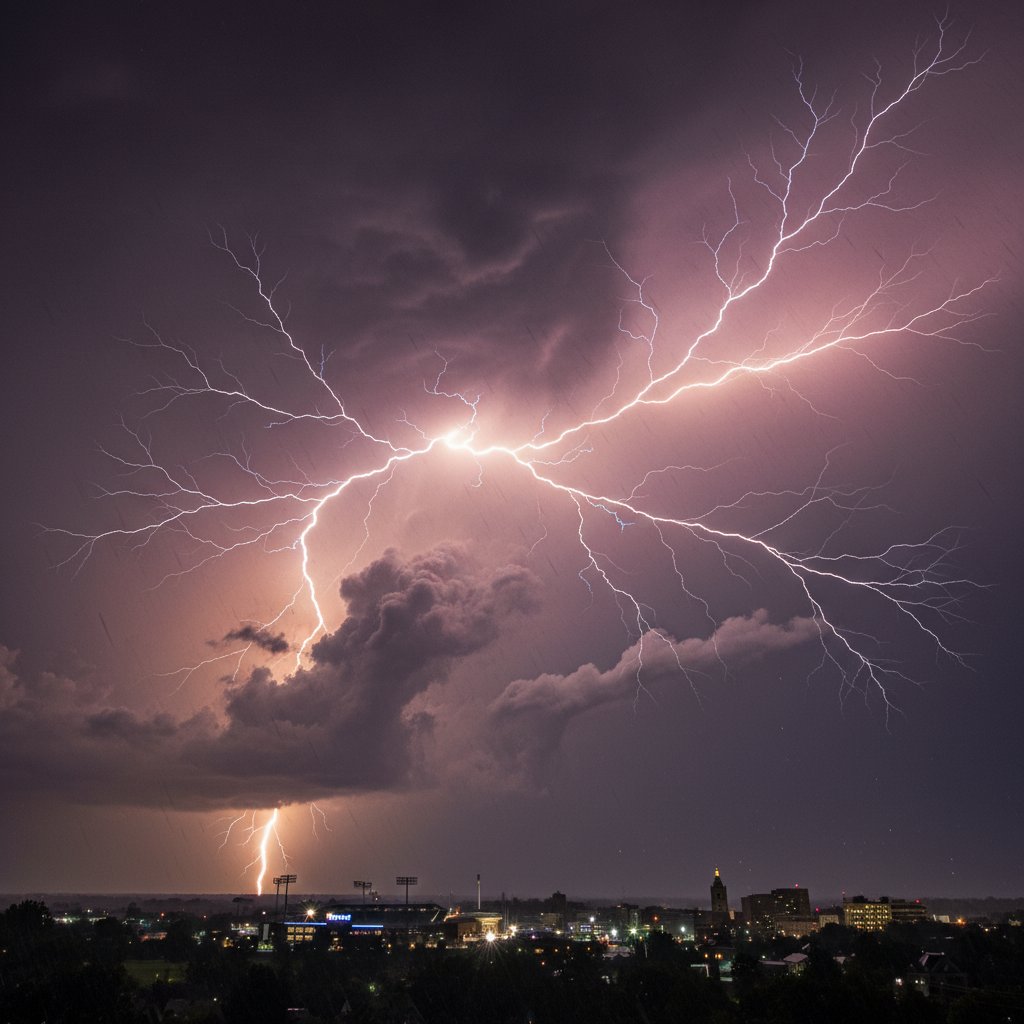
The sky over York, Pennsylvania, turned into a strobe light on the evening of April 15, 2025. For nearly two solid hours, cloud-to-ground lightning struck with such frequency that residents reported the horizon glowed continuously, as if someone had left a floodlight on behind the storm. “I’ve never seen lightning like this before,” said Mark Delaney, a lifelong York resident who watched from his back porch in the city’s northwest quadrant. “It wasn’t just a flash here and there—it was like a machine gun, one after another, sometimes three or four at the same time.”
What unfolded over York County that night was not your average spring thunderstorm. It was a mesoscale convective system with an embedded lightning supercell that produced an estimated 1,200 cloud-to-ground strikes within a 120-minute window, according to preliminary data from the National Lightning Detection Network (NLDN). That works out to an average of 10 strikes per minute—a rate that places this event among the top 0.1% of lightning episodes recorded in Pennsylvania over the past decade.
The Numbers Behind the Night
The most intense period occurred between 8:15 and 9:45 PM EDT. A lightning mapping array operated by the Penn State Weather Center tracked a cluster of strikes concentrated along a 12-mile corridor from York to Dallastown (roughly 39.96° N, 76.73° W to 39.86° N, 76.64° W). Maximum flash density reached 45 strikes per square kilometer per hour—more than triple the threshold that qualifies as “extreme” lightning activity.
Dr. Helen Tran, a research meteorologist at the National Severe Storms Laboratory, confirms the rarity. “What you saw over York was a classic ‘positive lightning outbreak’ embedded inside a bow echo. Positive strikes carry ten times the current of negative ones and can hit the ground five miles away from the parent cloud. In this case, the storm was producing as many positive as negative flashes, which is unusual for warm-season convection in Pennsylvania.”
The lightning was not just plentiful—it was dangerous. Nine separate ground strikes were reported to have hit structures, including a barn fire near Red Lion that destroyed a hay storage shed. Firefighters in Springettsbury Township responded to at least three surge-related transformer fires. The National Weather Service in State College issued a Lightning Emergency Warning at 8:47 PM, a rarely used alert that urges immediate sheltering. It was only the third such warning issued by NWS Central Pennsylvania since the protocol was introduced in 2022.
A Visual Assault on the Senses
Social media exploded with videos as residents captured the spectacle. One clip posted from the York Galleria mall parking lot shows a filamentous bolt splitting into three branches that appeared to touch down simultaneously. Another, taken near the Codorus Creek, records 14 seconds of near-constant illumination, with thunder rolling so continuously it sounds like a sustained bass note.
“What made this visually unique was the extraordinary number of ‘crawler lightning’ events—horizontal discharges that propagated along the base of the clouds,” explains John Corbin, a former NWS storm surveyor now with the Lightning Safety Alliance. “Crawler lightning is relatively rare because it requires a highly charged, horizontally stratified cloud structure. I’ve surveyed storms in Texas and Oklahoma for 20 years, and I can count the number of well-developed crawler displays on one hand. York had at least a dozen within an hour.”
The electrical fury also produced a phenomena known as “superbolt” flashes—strikes whose optical energy exceeds 100 megajoules per steradian. One such superbolt was recorded at 9:03 PM just south of York, registering a peak current of 325 kiloamperes. A typical cloud-to-ground strike measures around 30 kA. That single superbolt carried enough energy to power an average U.S. home for nearly a month—in less time than it takes to blink.
Why York? A Meteorological Breakdown
Meteorologists are still dissecting the atmospheric setup that turned a routine cold front into a lightning factory. Conditions on April 15 were characterized by a sharp dryline boundary to the west, pooling of rich Gulf moisture with surface dewpoints in the low 70s, and impressive mid-level lapse rates exceeding 7.5°C per kilometer. But the key ingredient was a long-lived, low-level jet streaming from the Ohio Valley, which provided a continuous supply of warm, humid air and reinforced the storm’s low-level inflow.
Dr. Tran notes a further factor: “We had a vigorous shortwave trough digging across the Great Lakes, and the vertical wind shear was ideal—0 to 6 km shear of 45 knots. That allowed the updraft to become highly tilted, which separated the charge regions inside the cloud and promoted the generation of the most energetic flashes. York was unfortunate enough to sit right under the sweet spot where the low-level jet intersected the storm’s outflow boundary.”
This is not merely a textbook case. The NWS office in State College has already scheduled a post-event survey to examine the potential for a new lightning intensity ranking scale, proposed earlier this year by a team at the University of Alabama in Huntsville. The York event could serve as a benchmark for what a “Category 5” lightning storm looks like.
What This Means for Residents and Future Preparedness
For the 450,000 residents of York County, the main takeaway is that lightning climatology in the mid-Atlantic may be shifting. While Pennsylvania averages about 2.5 million cloud-to-ground strikes per year, the frequency of high-density flash episodes like this one appears to be increasing. An analysis by the Electric Power Research Institute found a 16% rise in lightning-caused power outages across the Northeast from 2018 to 2023 compared to the prior five-year period.
If you live in York or anywhere in the Susquehanna Valley, the risk is real. “When you hear thunder, get inside. Don’t wait for the rain,” says John Corbin. “This storm produced lightning that hit seven miles from the rain core. That means you could be in a blue sky and still be in the kill zone. A standard 30/30 rule—if you can’t count to 30 between flash and thunder, stay inside for 30 minutes—still holds. But after what I saw in the data from York, I’d add: if you see even one flash from a distant storm, treat it as a direct threat.”
“We’re working with local emergency managers to revise lightning safety messaging. The old ‘when thunder roars, go indoors’ is good, but we need to stress that thunder can be inaudible in these high-altitude positive strikes. We’re considering a new catchphrase: ‘If you see a flash, take cover—fast.’” — Dr. Helen Tran
York’s lightning event also has economic implications. The Insurance Information Institute reports that lightning claims in Pennsylvania average $7,800 per residential incident. Multiply that by the estimated 150 structures that likely received a direct strike or near-miss during the outbreak, and the total could exceed $1 million in property damage. Business closures and traffic disruptions at major intersections—like Route 30 and I-83, where several lightning-related signals were knocked out—added further costs.
Looking ahead, forecast models indicate that similar atmospheric setups may occur again this spring, particularly if a persistent ridge over the southeastern U.S. channels moisture into the Northeast. The NWS is already monitoring a potential severe weather outbreak for late next week that could bring a repeat of high lightning densities to the Susquehanna Valley. For residents, the message is clear: the normal storm you grew up with may no longer be normal. The lightning over York on April 15 was not a freak one-off—it is a sign of a regime change in our atmosphere.
“I’ll never look at a summer thunderstorm the same way again,” says Delaney. “I used to enjoy watching the lightning from my deck. Now I think twice. When that sky starts going off like a giant camera flash, you get inside. Fast.”



