







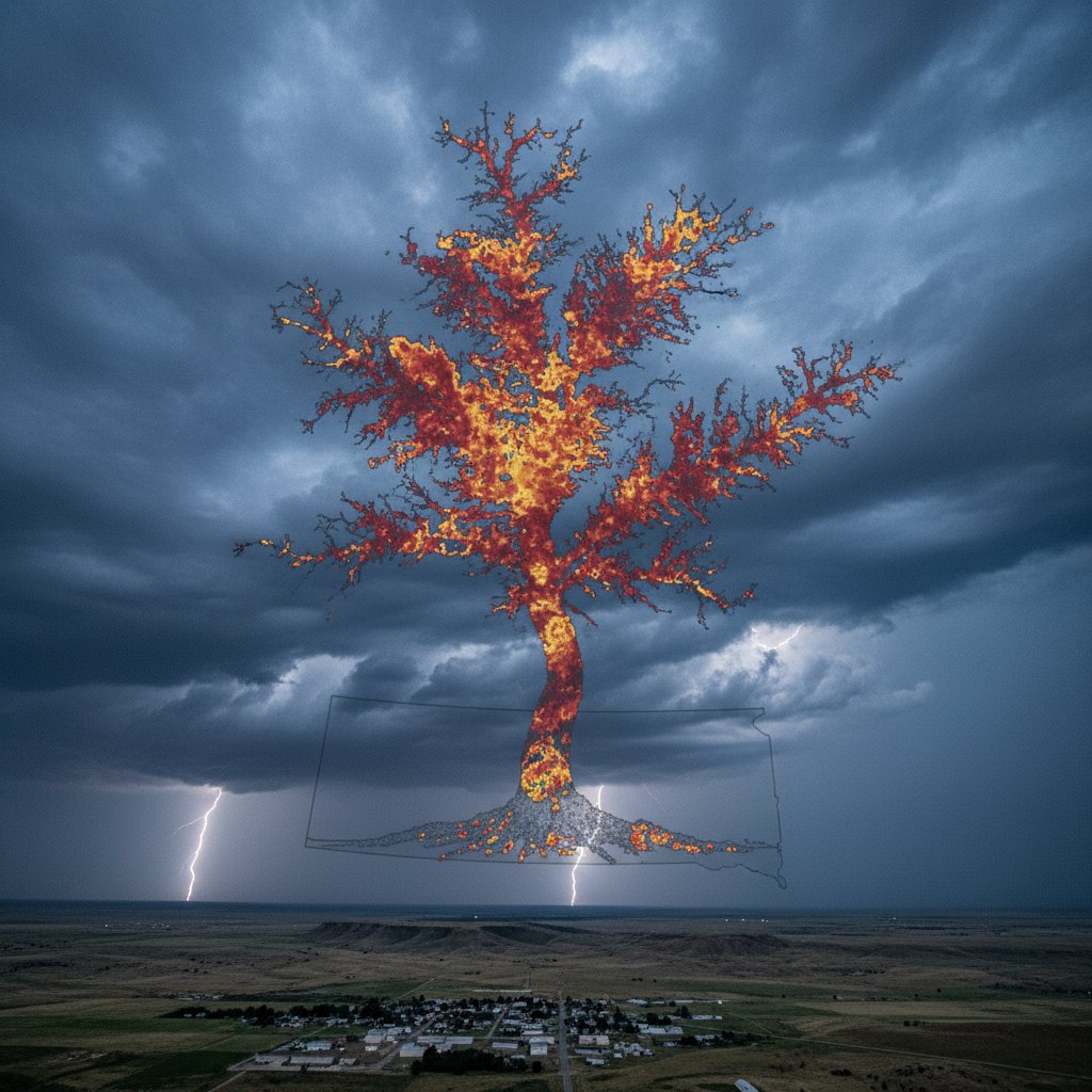
On the afternoon of May 14, meteorologists monitoring Doppler radar over the Great Plains noticed something they had never seen before: a vast, branching structure that looked exactly like a tree, seemingly growing out of the landscape of eastern South Dakota. The radar image, shared widely on social media, showed a network of precipitation echoes extending upward and outward like roots and branches, spanning dozens of miles. It was a fleeting moment—lasting less than two hours—but it left scientists and storm chasers alike scrambling for explanations.
“I’ve been doing this for 20 years, and I’ve never seen anything quite like it,” said Dr. Emily Hartley, a meteorologist with the National Oceanic and Atmospheric Administration (NOAA) in Sioux Falls. “It was as if the atmosphere decided to draw a tree using rain and hail.” The phenomenon, which occurred near the town of Huron, South Dakota, produced no tornadoes or major damage, but it raised questions about how radar can sometimes reveal hidden structures in storm systems.
The Discovery: A Tree in the Sky
The radar signature first appeared around 3:15 p.m. local time, when a cluster of thunderstorms began organizing over Beadle County. What made it unusual was the shape: a thick central trunk of intense precipitation, with thinner tendrils branching out to the southeast and northwest. The “tree” extended from about 5,000 feet to nearly 35,000 feet in altitude, with the crown reaching into the upper troposphere.
“It was a classic dendritic pattern—like you’d see on a winter windowpane, but on a massive scale,” said Prof. James Kowalski, an atmospheric scientist at the University of Nebraska-Lincoln. “But instead of ice crystals, it was made of raindrops and small hail.” The radar data showed reflectivity values exceeding 60 dBZ in the trunk, indicating heavy precipitation, while the branches had lower reflectivity, suggesting lighter rain or virga—rain that evaporates before hitting the ground.
Local residents reported only a brief, intense downpour and some pea-sized hail, but no widespread flooding. The storm quickly weakened as it moved eastward into Minnesota, leaving behind only a curious memory. “It was beautiful,” said Sarah Mitchell, a storm chaser based in Sioux Falls who photographed the radar loop. “But it also made you wonder: if the atmosphere can do this, what else can it do that we haven’t noticed?”
What Causes a Precipitation Tree?
Meteorologists are still debating the exact mechanism behind the “tree,” but early hypotheses point to a combination of wind shear and updraft organization. Typically, thunderstorms grow vertically when warm, moist air rises. But in this case, the storm’s updraft appeared to tilt and spread horizontally, creating the branching pattern.
“Imagine a strong updraft that’s being sheared by winds at different altitudes,” Dr. Hartley explained. “The core of the storm stays intact, but the precipitation gets blown out in layers. If the wind direction changes with height, you can get these branching structures.” The radar beam, which scans at multiple angles, may have captured a snapshot of this complex three-dimensional airflow.
Another factor could be the presence of a “rear inflow jet”—a stream of dry air that sometimes wraps around a storm’s backside. This jet can undercut the updraft, causing precipitation to fall in streaks that look like branches on radar. “It’s a known phenomenon in supercell thunderstorms, but rarely does it form such a perfect tree shape,” Prof. Kowalski added. “Usually, you get messy patterns. This was unusually symmetric.”
Weather radar itself can produce artifacts, such as “beam blockage” from terrain or “anomalous propagation” from temperature inversions. However, the tree pattern was observed on multiple radar scans and confirmed by nearby weather stations. “This was real,” emphasized Mitchell. “It wasn’t a glitch. The atmosphere literally grew a tree.”
Human Impact: What This Means for Plains Residents
For communities in the central Great Plains, where severe weather is a way of life, understanding unusual radar patterns can improve forecast accuracy. While the “tree” didn’t produce a tornado, its structure hinted at a highly organized storm that could have become severe under slightly different conditions.
“This shows that even non-tornadic storms can have complex internal dynamics,” Dr. Hartley said. “We need to study these events to better predict when a storm might intensify or produce damaging winds.” The National Weather Service is now reviewing the radar data to see if the tree pattern correlates with any other storm parameters, such as rotation or hail size.
For farmers in the region, the precipitation brought welcome moisture—about 0.75 inches on average—but the localized nature of the storm meant some fields got drenched while others remained dry. “It’s a reminder of how variable spring weather can be,” said Kowalski. “One field gets a tree of rain, and another gets nothing.”
Social media reactions ranged from awe to confusion. “People were asking if it was a sign of something supernatural,” laughed Mitchell. “But it’s just science—beautiful, strange science.” The image has since been shared thousands of times, with some comparing it to the “Ghost Radar” phenomenon or the “Lake Michigan smoke plume” of 2022.
The Bigger Picture: Climate and Radar Anomalies
Could this “precipitation tree” become more common in a warming climate? Warmer air holds more moisture, potentially fueling more intense thunderstorms. Some studies suggest that storm updrafts may become stronger and more tilted under future climate scenarios, creating conditions that favor unusual radar patterns.
“We don’t have enough data to say if this is a climate signal,” Prof. Kowalski cautioned. “But it’s worth monitoring. If we start seeing more of these dendritic structures, it might indicate changes in how storms are organizing.” NOAA plans to deploy additional mobile radar units to the northern Plains this summer to capture similar events.
For now, the “tree of South Dakota” remains a meteorological curiosity—a reminder that even with advanced technology, the atmosphere can still surprise us. “Every radar scan is a piece of art,” said Dr. Hartley. “Sometimes it just happens to look like a tree.” As the storm season unfolds, meteorologists will keep watching the skies, waiting for the next hidden masterpiece to reveal itself.
What does this mean for you? If you live in the Great Plains, stay tuned to local radar apps—you might spot the next “tree” before it fades. And remember: the most extraordinary weather often appears in the most ordinary moments. The tree of South Dakota may have vanished, but it has planted a seed of curiosity that will grow for years to come.



