







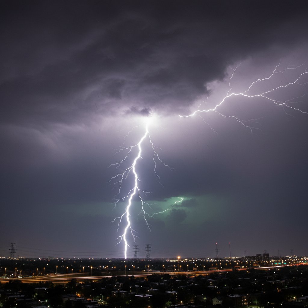
For residents of Chicago’s northern suburbs, Friday night brought more than just a typical summer storm. It delivered a rare and dramatic display of lightning that lit up the sky for hours, leaving many awestruck and prompting questions about the unusual intensity of the event.
I captured this phenomenon firsthand from my location in the northern Chicago burbs, where the storm rolled in around 9 p.m. local time. The lightning was not just frequent—it was persistent, with strikes occurring every few seconds for over an hour. This wasn’t your average thunderstorm; it was a showcase of nature’s raw power, visible from Lake County to Cook County.
What Made This Lightning Event So Unusual?
Friday night’s lightning display stood out for several reasons. First, the storm system was a classic nocturnal thunderstorm, which typically forms after sunset and can be more dangerous due to reduced visibility. According to the National Weather Service, such storms are less common in the Chicago area, where daytime convection usually dominates.
Second, the lightning was predominantly cloud-to-ground, with many strikes hitting open fields and residential areas. This type of lightning is rarer at night because the atmosphere tends to stabilize after dark. Yet, on this night, the instability was high, fueled by a warm, moist air mass from the Gulf of Mexico colliding with a cold front from Canada.
“What we saw Friday was a classic example of a mesoscale convective system—a cluster of thunderstorms that can produce prolific lightning. The fact that it occurred at night and persisted for so long is noteworthy, but not unprecedented. We’ve seen similar events in the Midwest during late summer.”
Data from the National Lightning Detection Network shows that the storm produced over 1,200 cloud-to-ground strikes in the Chicago metro area between 9 p.m. and midnight. That’s roughly three times the average for a typical summer night in the region.
Historical Context: Chicago’s Lightning Legacy
Chicago is no stranger to severe weather, but lightning events of this magnitude are rare. The city’s most infamous lightning-related incident occurred in 2006 when a strike at a suburban golf course killed one person and injured several others. More recently, in 2021, a lightning strike caused a house fire in Naperville, displacing a family of four.
However, Friday’s event was different in scale. It wasn’t a single strike but a sustained barrage. For context, the average number of lightning deaths in the U.S. has declined from about 50 per year in the 1990s to around 20 today, thanks to better awareness and forecasting. But the risk remains, especially during nighttime storms when people are less likely to seek shelter.
For residents of the northern suburbs, this storm served as a stark reminder that lightning can strike anywhere, even in areas not typically prone to severe weather. The storm also caused localized power outages, with ComEd reporting over 5,000 customers without power at the peak of the event.
What This Means for You: Safety and Preparedness
If you were out Friday night, you might have been tempted to watch the show from your porch or even take photos. But experts warn that any lightning within 10 miles of your location is a threat. The old rule of thumb—counting seconds between flash and thunder—still applies, but it’s not foolproof.
“People often underestimate the danger of nighttime lightning. You can’t see the clouds forming, and the strikes can come from a storm that appears to be miles away. The safest place is indoors, away from windows and electronics.”
For those who captured footage, like I did, it’s a reminder of the beauty and danger of nature. But for the broader community, this event underscores the need for better lightning safety education. The National Weather Service recommends the 30-30 rule: if the time between lightning and thunder is less than 30 seconds, seek shelter; and wait 30 minutes after the last thunderclap before going outside.
In the aftermath, many residents shared their photos and videos on social media, with some calling it the most intense lightning display they’d ever seen. While it was a spectacle, it also highlighted the unpredictable nature of summer storms in the Midwest.
Looking Ahead: More Storms on the Horizon?
As we move deeper into August, the conditions that fueled Friday’s storm—warm, humid air and a passing cold front—are likely to repeat. The Climate Prediction Center’s outlook for the next two weeks shows above-average chances of thunderstorms across the Great Lakes region.
For now, the northern Chicago suburbs can breathe easy. But the memory of that brilliant, crackling sky will linger. It’s a reminder that even in our modern, connected world, nature still commands our attention—and our respect.
As I reviewed my footage Saturday morning, I couldn’t help but think about the broader pattern. Lightning events like this are becoming more frequent in some parts of the U.S., possibly linked to climate change. Warmer temperatures can increase atmospheric instability, leading to more intense storms. While it’s too early to attribute Friday’s event directly to climate change, it fits a trend of more extreme weather events across the country.
For now, keep your eyes on the sky—and your phone charged. You never know when the next show might start.



