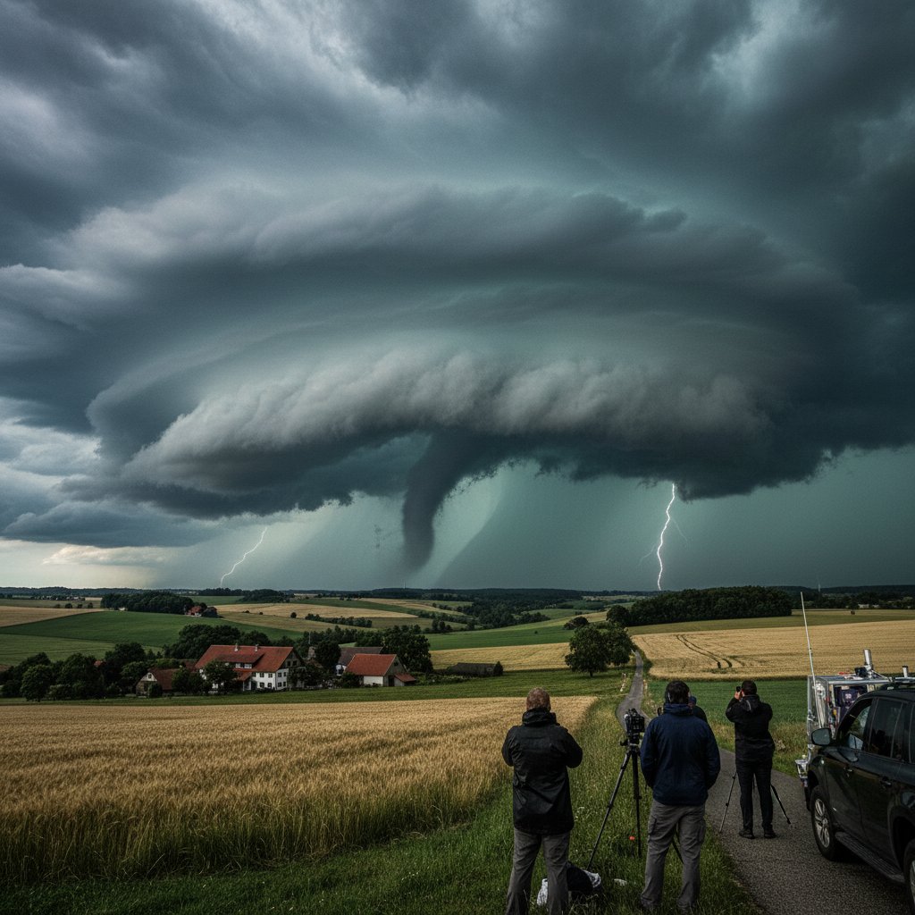
On a humid July afternoon in 2023, the skies over Paderborn, Germany, turned a sickly green. Residents watched in disbelief as a funnel cloud descended from a seemingly unremarkable layer of clouds. Within minutes, a tornado was tearing through the outskirts of the city, flipping cars and snapping century-old oaks like twigs. To American storm chasers, the setup looked wrong: barely 500 J/kg of CAPE (Convective Available Potential Energy) and wind shear pushing 25 m/s. Yet there it was—a classic low CAPE, high shear tornado, a phenomenon that is surprisingly common across Germany and much of central Europe.
These events are a meteorological paradox. In the United States, the Great Plains are famous for explosive supercells with CAPE values exceeding 4,000 J/kg. But in Germany, storms often fire with a fraction of that energy, relying instead on powerful wind shear to organize into rotating mesocyclones. The result? Tornadoes that are often weaker than their US counterparts—typically EF0 to EF2—but still deadly and damaging, and far more frequent than many realize.
The Physics of a Low CAPE, High Shear Setup
To understand why Germany is a hotspot for these storms, we have to look at the atmospheric recipe. CAPE measures the energy available for upward motion—thunderstorm fuel. High shear, on the other hand, measures the change in wind speed and direction with height. In classic US tornado outbreaks, both are high. In Germany, the CAPE is often modest, but the shear is intense, especially in spring and autumn when the jet stream dips over Europe.
Dr. Hannah Richter, a meteorologist at the German Weather Service (DWD), explains:
“In Germany, we often see what we call ‘shear-driven’ storms. The wind field is so strong that it can organize even weak updrafts into rotating storms. This is why we can get tornadoes from what looks like a mild thunderstorm on satellite.”
These systems typically form along cold fronts or in the warm sector of a low-pressure system moving in from the Atlantic. The low CAPE means storms are often shallow, but the high shear tilts the updraft, creating a persistent mesocyclone. The result is a tornado that can form quickly, often with little warning. In 2021, a low CAPE/high shear setup produced an EF2 tornado in the city of Tönisvorst, killing one person and injuring dozens.
Why This Looks Strange to American Eyes
For US storm chasers and meteorologists, the low CAPE values are the first red flag. “In Oklahoma, we wouldn’t even issue a severe thunderstorm warning with those numbers,” says Mark Thompson, a veteran storm chaser based in Texas.
“But in Germany, they get tornadoes from what we’d call a garden-variety storm. It’s a completely different ballgame.”
The difference lies in the geography. The US Great Plains have a deep, dry layer aloft that suppresses convection until it can finally break through with explosive force. In Germany, the atmosphere is often more saturated, meaning less CAPE is needed to sustain a thunderstorm. The shear, however, is often comparable to that found in US severe weather outbreaks. This creates a storm that is less violent on average but more unpredictable.
For American readers, think of it this way: a low CAPE/high shear storm is like a lightweight boxer with incredible speed. It might not pack the knockout punch of a heavy weight, but it can land precise, damaging blows in a hurry. Germany experiences an average of 20 to 30 tornadoes per year, though many go unreported because they occur in rural areas or are short-lived. The low CAPE/high shear setup is responsible for the majority of these events.
Historical Context: Tornadoes in Germany Are Not New
The perception that tornadoes are rare in Germany is a dangerous myth. Historical records show that these storms have been occurring for centuries. One of the earliest documented tornadoes struck the village of Woldegk in 1767, rated as an F4—one of the strongest ever recorded in Europe. More recently, in 2015, a tornado outbreak in the state of North Rhine-Westphalia caused €50 million in damages, covering a path of over 30 kilometers.
Dr. Richter notes that the frequency of these events may be increasing.
“Climate models suggest that as the jet stream becomes more wavy, we could see more of these high-shear events in the future. That means Germany needs to invest in better detection and public awareness.”
Currently, Germany lacks a dedicated tornado warning system. The DWD issues general severe thunderstorm warnings, but specific tornado alerts are rare. This is a major gap, given that low CAPE/high shear tornadoes can form with little warning—sometimes only 10 to 15 minutes of lead time from the first radar detection of rotation.
What This Means for Europe and the US
For European readers, the takeaway is clear: a cloudy, rainy day with a strong wind shift can produce a tornado. Pay attention to weather warnings, especially if you live in the western or northern parts of Germany, where these setups are most common. For American readers, this serves as a reminder that tornadoes are not just a US phenomenon. The same physics that produce tornadoes in Kansas can also produce them in Germany, albeit with a different energy profile.
As climate change continues to alter atmospheric patterns, the line between “typical” and “atypical” tornado regions is blurring. The low CAPE/high shear setup is a textbook example of how local geography and global weather patterns interact in unexpected ways. For storm enthusiasts, studying these events offers a new frontier—one where the rules are different, but the threat is just as real.
Looking ahead, German researchers are pushing for a European tornado database and improved radar coverage. Until then, the best defense is awareness. The next time you see a dark sky over Hamburg or Berlin, remember Paderborn. It doesn’t take a supercell to spin up a twister—just the right mix of low energy and high shear.