







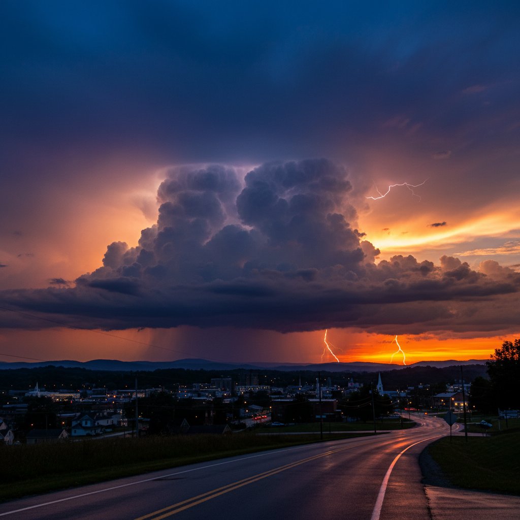
On the evening of April 17, residents of Johnson City, Tennessee, were treated to a spectacle that stopped traffic and flooded social media: a towering thundercloud, its anvil-shaped top painted in fiery shades of orange, pink, and purple by the setting sun. The image, captured by dozens of locals and shared widely, is both breathtaking and telling—a natural artwork that also carries a warning. Thunderclouds like this one can reach heights of 60,000 feet, and their beauty often masks the violent potential within.
A Photographer’s Dream: The Phenomenon
The Johnson City thundercloud was a classic cumulonimbus incus—a mature thunderstorm that has reached the tropopause and spread out into an anvil shape. What made it exceptional was the timing: sunset, when low-angle sunlight illuminates the cloud’s ice crystals and water droplets from below, creating a luminous display that can appear almost surreal.
Such sunsets are not rare, but they are fleeting. The colors depend on the composition of particles in the atmosphere—dust, pollution, and moisture—and the angle of the sun. In this case, a clear sky to the west allowed unobstructed rays to hit the thunderhead, while the storm itself was moving eastward, away from the viewer. The result was a perfect alignment of light and cloud.
“What we saw was a textbook example of how thunderstorms can become transient works of art,” said Dr. Emily Carter, a meteorologist with the National Oceanic and Atmospheric Administration (NOAA). “But the same cloud that delights photographers can, in another moment, produce hail, damaging winds, or even a tornado. It’s a duality we have to respect.”
The Anatomy of a Thundercloud: From Color to Danger
To understand the significance of the Johnson City sunset, one must look inside the cloud. A mature cumulonimbus is a violent engine. Updrafts can exceed 100 miles per hour, lifting water droplets to heights where they freeze and grow into hailstones. The anvil top, visible in the photos, is made of ice crystals spread by upper-level winds. It is a sign that the storm has reached its peak intensity.
For Johnson City, located in the Appalachian foothills, such storms are a regular feature of spring and summer. The region’s topography often enhances storm development as moist air is forced upward by the mountains. While this particular thundercloud did not produce severe weather—the National Weather Service reported no warnings in effect for that area at the time—it could have. The line between a picturesque sunset and a destructive hailstorm is often measured in miles and minutes.
Historically, the Southern Appalachian region has experienced some of its most notable severe weather events in April and May. The 1998 Nashville tornado outbreak, though centered further west, was preceded by similarly dramatic stormscapes. The Johnson City sunset serves as a reminder that spring is the season of atmospheric extremes.
A Climate Context: Shifting Storm Patterns
While the thundercloud sunset is a natural occurrence, its context is shifting. Climate data shows that the frequency of severe thunderstorms in the southeastern United States has increased by roughly 20% over the past 50 years. Warmer temperatures allow the atmosphere to hold more moisture, fueling more intense updrafts and more explosive cloud development.
Dr. James Liu, a climate researcher at the University of Tennessee, Knoxville, notes that the Appalachians are a ‘hotspot’ for changing storm behavior. “We are seeing a trend where the environment that produces these towering cumulonimbus clouds is becoming more available,” he said. “A beautiful sunset like this one might become more common, but so will the storms that produce it. The two go hand in hand.”
This is not to say that every thundercloud sunset signals a new climate anomaly. But when viewed against the backdrop of rising global temperatures, the stunning purple and orange hues take on added weight. They are a visual reminder of the energy that the atmosphere is packing.
“It’s easy to get lost in the aesthetics,” said Dr. Liu. “But as a scientist, I look at that anvil shape and think about how much instability is in the air. The same dynamics that make it beautiful are the ones that make it dangerous. We need to appreciate nature’s shows without forgetting their lessons.”
What This Means for Residents: Beauty and Preparedness
For residents of Johnson City and similar communities across the US, UK, and Canada, the thundercloud sunset is a call to awareness. It’s not enough to snap a photo and move on. Knowing how to read the sky can save lives. A dark, rainbow-colored anvil—sometimes called a ‘stacked anvil’—can indicate a severe storm with strong wind shear. The colors themselves, while mesmerizing, can also be a sign of large hail high in the cloud.
Emergency managers in the region urge people to check weather apps and warnings when they see such displays. “If you see a thundercloud sunset, especially one that looks as dramatic as the one in Johnson City, the first thing you should do is look at the radar,” said Mark Evans, a former county emergency coordinator in northeastern Tennessee. “It might be moving away from you, or it might be coming straight for you. Don’t assume it’s just a photo op.”
Social media posts from that evening show that many residents did just that—sharing the sunset alongside updates on local weather. The community response was largely one of awe, but also of caution. Several commenters noted that the storm had passed over their homes an hour earlier with heavy rain and gusty winds.
As spring deepens and summer approaches, the stage is set for more of these dual-nature events. The Johnson City thundercloud sunset is a perfect example of how weather can be both a splendor and a threat. For those who witnessed it, the memory will linger—a reminder that nature’s most beautiful moments are often entwined with power we should never take for granted.
Looking ahead, climatologists expect that the Southeast will continue to see an increase in thunderstorm days. That means more anvil tops painted by sunset, more jaw-dropping photos, and more need for vigilance. The sky is writing its own story, and we are all reading it in real time.



