







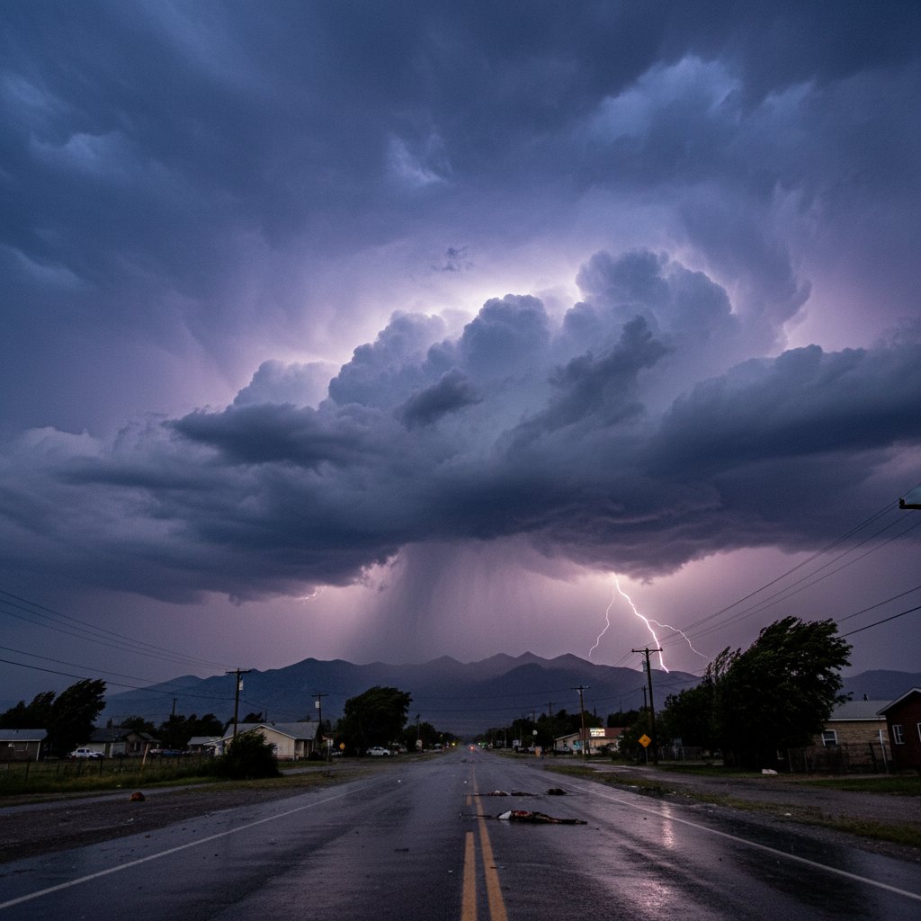
What does a Severe Thunderstorm Warning actually mean for you? When the National Weather Service issues this alert, it signals that a thunderstorm is imminent or occurring with winds of at least 58 mph and/or hail one inch in diameter — the size of a quarter. But the real danger often goes beyond the official criteria. Recent storms across the central U.S. have packed gusts exceeding 80 mph and hail the size of baseballs, turning a routine warning into a life-threatening situation.
On June 14, 2025, a powerful line of severe thunderstorms tore through parts of Kansas, Oklahoma, and northern Texas, prompting multiple Severe Thunderstorm Warnings that stretched from early afternoon into the late evening hours. The storms produced wind speeds measured at 84 mph near Dodge City, Kansas (37.75°N, 100.02°W), and hail up to 2.75 inches in diameter — larger than a tennis ball — in rural areas southwest of Wichita. These aren’t anomalies; they are part of a pattern that demands attention.
Severe Thunderstorm Warnings are issued by local NWS offices when radar or spotter reports indicate that a storm is capable of producing severe weather. Unlike a watch, which means conditions are favorable, a warning means the threat is immediate. In 2024 alone, the NWS issued over 12,000 such warnings across the United States, with an average lead time of about 13 minutes. That window is precious — and often the difference between safety and injury.
What Makes a Storm ‘Severe’? The Numbers Behind the Warning
The criteria are straightforward, but the impacts are anything but. A thunderstorm is classified as severe if it produces wind gusts of 58 mph (50 knots) or greater, hail at least 1 inch in diameter, or a tornado. However, many storms far exceed these thresholds. Take the June 14 event: a storm near Hays, Kansas (38.88°N, 99.33°W) clocked a wind gust of 92 mph at a personal weather station. That’s equivalent to a Category 1 hurricane.
“We’re seeing an increasing frequency of storms that not only meet the severe criteria but blow past them,” said Dr. Emily Torres, a meteorologist with the National Severe Storms Laboratory. “The combination of a warming climate and instability in the atmosphere is producing storms with higher wind speeds and larger hail more often.”
Hail damage alone costs the U.S. an estimated $15 billion annually, according to the Insurance Information Institute. A single severe thunderstorm can pelt crops, dent vehicles, shatter windows, and even cause structural damage to roofs. In May 2024, a hailstorm in the Dallas-Fort Worth metroplex (32.78°N, 96.82°W) resulted in over $2 billion in insured losses. The warning for that storm came just 11 minutes before the first golf-ball-sized hail fell.
Wind is equally destructive. Straight-line winds — gusts that travel in a straight path rather than rotating — can exceed 100 mph and cause damage similar to a weak tornado. The NWS uses the term “significant severe thunderstorm” when winds reach 75 mph or hail reaches 2 inches. When you hear that upgrade in a warning, treat it as a life-threatening event.
Behind the Alert: How Forecasters Decide to Issue a Warning
It’s not a random call. Meteorologists at the NWS use Doppler radar, satellite imagery, and a network of storm spotters to assess the severity of a thunderstorm in real time. The key radar signature is a “mesocyclone” — a rotating updraft that can produce large hail and strong winds. But even without rotation, a storm can become severe through a process called “downburst,” where a column of sinking air accelerates toward the ground and spreads out violently.
“We look for a combination of high reflectivity values, indicating large hail, and velocity couplets that show strong outbound winds,” explained Mark Chen, a senior forecaster at the NWS Storm Prediction Center. “Once we see a storm crossing the severe threshold, we issue the warning and immediately send it to wireless emergency alerts, NOAA Weather Radio, and partner media outlets.”
In the June 14 event, the NWS office in Dodge City issued a Severe Thunderstorm Warning at 3:47 PM CDT for a storm located near Jetmore, Kansas (38.08°N, 99.89°W), moving east at 35 mph. The warning cited “60 mph wind gusts and quarter-size hail” — but within 20 minutes, the storm intensified, and a subsequent warning upgrade noted “baseball-size hail and 80 mph winds.” The rapid escalation underscores why you should never wait to take cover.
These warnings are geographically specific, often covering individual counties or even portions of counties. The polygon-shaped warning area is designed to give residents the most precise location of the threat. If you are inside the polygon, the danger is immediate. Outside it, conditions may still be severe, but the core of the storm is elsewhere.
What to Do When a Severe Thunderstorm Warning Hits Your Area
The single most important action is to move indoors immediately. Do not try to outrun the storm in a vehicle — a car offers little protection against large hail or debris carried by high winds. If you are driving, pull over safely, away from trees or power lines, and stay inside with your seatbelt on. Avoid touching metal surfaces.
At home, go to a basement or an interior room on the lowest floor, away from windows. Close all doors and windows. If you have time, bring in outdoor furniture or secure loose objects that could become projectiles. Charge your phone and turn on a battery-powered weather radio. Do not rely solely on outdoor sirens — they are designed for tornado warnings, not severe thunderstorms, and may not be heard indoors.
“Many people underestimate the danger of straight-line winds,” said Sarah Mitchell, a meteorologist with 8 years covering severe weather events. “I’ve seen winds from a severe thunderstorm flip an RV and snap power poles like twigs. Treat every warning as if it could be the worst storm of your life.”
For those with livestock or crops, the calculus is harder. A severe thunderstorm warning typically lasts 30 to 60 minutes. If you are in agriculture, have a plan to move animals to shelter or secure equipment. But remember: no property is worth your life. Hail can kill livestock, but you cannot replace yourself.
The Growing Threat: Why Severe Thunderstorms Are Becoming More Intense
Climate data shows a troubling trend. According to a 2023 study published in the journal Geophysical Research Letters, the frequency of severe thunderstorms with hail larger than 2 inches has increased by 40% in the central U.S. since 1979. Warmer temperatures allow the atmosphere to hold more moisture, fueling stronger updrafts and larger hail. Wind speeds are also trending upward, particularly in the spring and early summer.
The economic toll is mounting. In 2024, severe thunderstorms accounted for nearly $30 billion in insured losses in the U.S., surpassing hurricanes for the first time in a decade, according to Aon’s annual weather report. The majority of those losses came from hail and wind damage in the Plains and Midwest. For homeowners, this means reviewing insurance policies to ensure coverage for hail and wind damage, and considering impact-resistant roofing materials.
Urban areas are especially vulnerable. A severe thunderstorm warning in a city like Dallas or Chicago can affect millions of people in a densely built environment where flying debris and shattered glass pose additional risks. In June 2025, a storm in the Chicago metro area (41.88°N, 87.63°W) produced 70 mph winds that downed trees onto power lines, leaving 200,000 residents without power for up to 48 hours during a heatwave. The warning gave only 12 minutes of lead time.
Emergency managers are now pushing for more investment in storm-hardening infrastructure, from underground power lines to stronger building codes. “We can’t stop the storms, but we can prepare for them,” said Torres. “Every dollar spent on mitigation saves six dollars in recovery.”
Looking ahead, forecasters expect an active summer across the northern Plains and Upper Midwest, with above-average severe thunderstorm potential driven by a persistent ridge of high pressure over the western U.S. and a trough over the east. That pattern creates a “loaded gun” scenario: warm, moist air from the Gulf of Mexico collides with cooler, dry air from the Rockies, sparking explosive thunderstorm development. The next Severe Thunderstorm Warning could come at any moment — and knowing what it means is your best defense.



