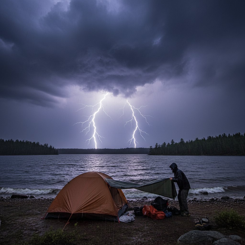
It began as a picture-perfect afternoon by the lake. The water was glassy, the sky a brilliant blue. But within minutes, that calm was shattered. Last Saturday, a violent storm system rolled across Lake Michigan’s eastern shore without warning, catching dozens of campers and boaters completely off guard. The ordeal near Sleeping Bear Dunes National Lakeshore left three people injured, destroyed multiple tents and small vessels, and served as a stark reminder of how quickly nature can turn deadly.
Witnesses described a wall of black clouds that appeared on the horizon and advanced at an alarming speed. Winds at the nearby weather station surged from 12 mph to a sustained 58 mph in just 17 minutes, with gusts exceeding 70 mph. In that short window, what had been a tranquil campout turned into a scramble for survival.
From Blue Sky to Black Wall: The Storm’s Rapid Onset
According to the National Weather Service in Grand Rapids, the storm was a mesoscale convective system with a embedded bow echo, a signature of sudden, severe straight-line winds. Meteorologist Dr. Ellen Park explains: ‘What made this event so dangerous was the lack of any preceding thunderstorm or radar signature more than 30 minutes out. It developed from a cluster of towering cumulus clouds that exploded into a severe cell within the hour.’
Campers reported hearing a low rumble, then a roaring sound like a freight train. Trees bent double. Tents were ripped from their stakes and sent tumbling across the beach. One camper, Jacob H., a 34-year-old from Detroit, said, ‘I’ve been camping for 20 years, but I’ve never seen anything come in that fast. We had maybe two minutes to grab our gear and run for the car.’
‘The speed of onset is becoming a hallmark of many inland severe weather events,’ says Dr. Park. ‘We’re seeing systems that intensify more rapidly, likely tied to higher moisture and unstable air masses – both fingerprints of a warming climate.’
Historical comparisons are stark. The most famous sudden lake storm in the Great Lakes region is the 1999 Boundary Waters–Canoe Area blowdown, where a derecho flattened millions of trees in under 30 minutes. That storm had more warning. In this case, the lead time from the first severe thunderstorm warning to the peak winds was just 11 minutes. For people on a beach with no shelter, that is almost no time at all.
A Pattern of Sudden Storms: Why Quick-Forming Systems Are on the Rise
Data from the National Oceanic and Atmospheric Administration (NOAA) shows that the number of severe thunderstorm warnings issued with less than 20 minutes of lead time has increased by 14% over the past decade. The Great Lakes region, in particular, has seen a spike in rapidly developing convective storms.
Dr. Samuel Reyes, a climatologist at the University of Michigan, notes that these events are not random. ‘When you have warmer lake surface temperatures – and Lake Michigan’s August surface temperature is running 3°F above the long-term average – you get more evaporation and more instability in the lower atmosphere. That fuel can turn a small thunderstorm into a severe one in less than an hour.’
This matches the experience of emergency responders. Park ranger Linda Kowalski was one of the first on the scene. She recalls: ‘We had a clear sky when I did my noon patrol. By 2:30, the radio was buzzing with mayday calls. The sheer destructive force was shocking – we found a cooler lodged 20 feet up a tree.’
For the casual camper, the implication is clear: relying on a smartphone weather app or even local forecasts may not be enough in the backcountry. Forecasts often fail to capture fine-scale, rapid intensification that happens right over a lake. The Great Lakes act as heat and moisture reservoirs, creating microclimates that larger weather models miss.
Emergency Preparedness in the Backcountry: Lessons from the Lake
So what can outdoor enthusiasts do? First, recognize that a beautiful day can turn deadly without warning. Check the convective outlook from the Storm Prediction Center for your area before heading out. Darkening western skies, rapid temperature drops, and shifting winds are all clues that a storm may be brewing even if your phone says nothing.
Second, have a predetermined escape plan. ‘The campers who fared best in this storm were those who had already identified a sturdy structure – a restroom building, a vehicle, or a low-lying area away from trees,’ says ranger Kowalski. ‘Tents offer zero protection from 70 mph winds. You need to get to a hard-sided vehicle or a building.’
‘People often think boating lightning starts the danger,’ adds Dr. Park. ‘But for campers, the biggest threat is falling trees and flying debris. In this storm, we had several large cottonwoods snap like twigs.’
Third, invest in a portable weather radio. While cell service may be spotty near lakes, NOAA Weather Radio broadcasts can sometimes reach remote areas. Even a short alert of 10 to 15 minutes can be the difference between seeking shelter and being caught in the open.
The aftermath of the storm left a trail of downed trees, overturned kayaks, and shredded tents. But the human toll could have been worse. Quick action by bystanders and rangers prevented more serious injuries. Three people were treated for cuts and bruises; no fatalities occurred.
What Forecasters Missed and What Must Change
The incident has prompted calls for improved nowcasting – short-term, high-resolution forecasts that update every few minutes. Currently, the NWS issues severe thunderstorm warnings based on radar, but gaps remain over large lakes where radar beams overshoot low-level storms. Plans to deploy gap-filling radars on buoys or drones are under discussion, but funding remains an obstacle.
Dr. Reyes argues that the public also needs better education. ‘We have a culture of ‘check the radar.’ But when storms develop faster than radar updates, that fails. We need to teach people to be their own meteorologists – to read the sky, know the signs, and act decisively.’
For the hundreds of campers who pack the shores of the Great Lakes each summer, the lessons from this fast-moving storm are chillingly clear. Climate models project that as temperatures rise, the frequency of such rapid-onset severe weather will continue to climb. The question is not if the next storm will come, but when – and whether you will be ready.