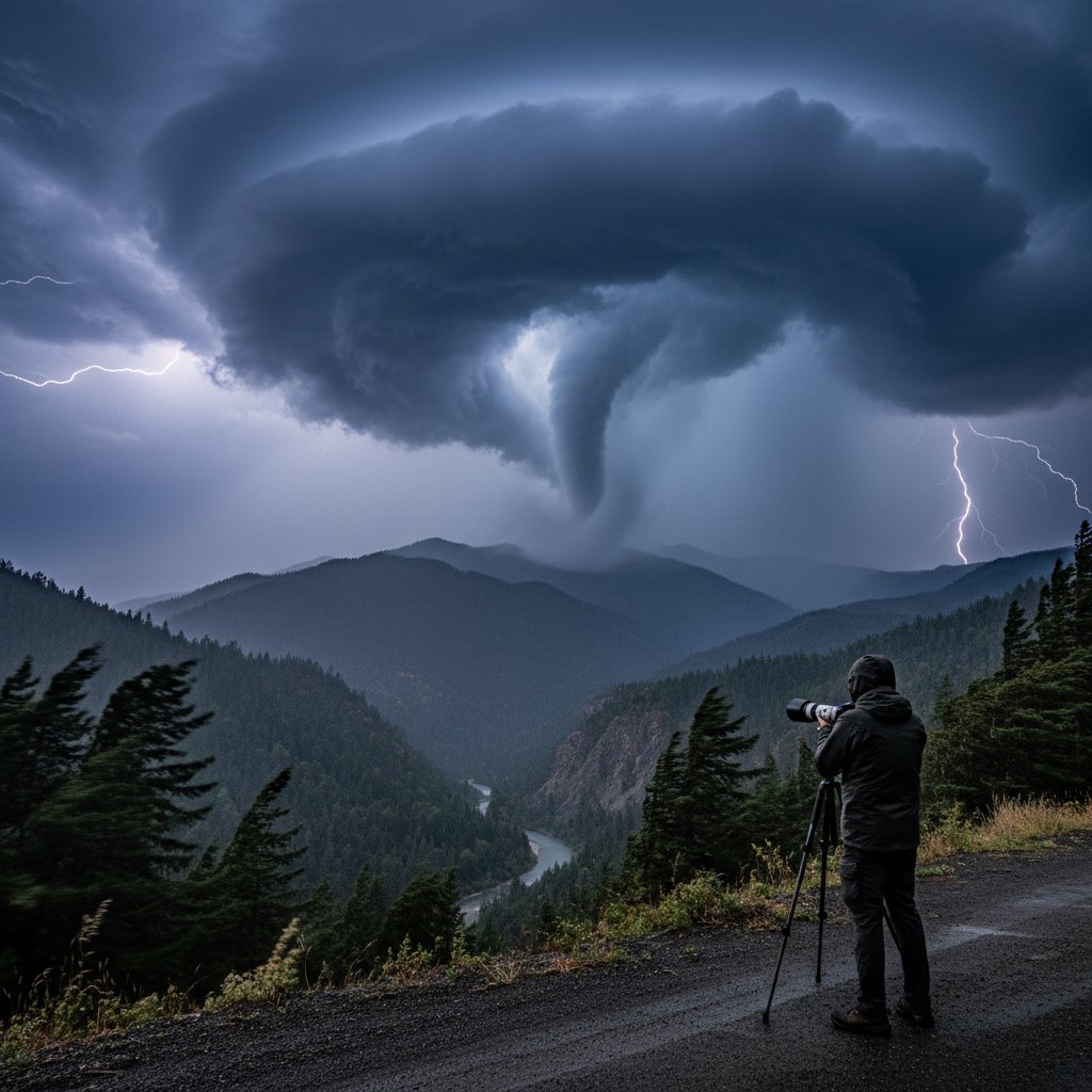
For residents of Northern California, tornadoes are about as common as snowballs in July. But on the afternoon of March 15, 2025, a dramatic video captured by storm chaser Jake Morrison changed that perception. “I was recording for a while before I finally caught this one,” Morrison told CyclonePost, describing the moment a funnel cloud touched down near the small town of Williams, about 90 miles north of Sacramento. The footage, which quickly went viral, shows a slender but distinct twister tearing across open farmland, kicking up dust and debris before dissipating within minutes. While no injuries were reported, the event has left meteorologists and residents asking: Is this a sign of shifting weather patterns in California?
The bigger picture is not just about one storm. This tornado, rated EF0 on the Enhanced Fujita scale, occurred in a region where such phenomena are statistically negligible. According to NOAA’s Storm Prediction Center, California averages only 11 tornadoes per year, most of them weak and short-lived, and the vast majority occur in the Central Valley or along the coast. A tornado in the northern part of the state, far from the typical spring storm tracks, is a statistical outlier — but one that fits a broader trend of unusual weather extremes.
A Rare Event with Familiar Ingredients
Meteorologists emphasize that the atmospheric setup for this tornado was not unprecedented, but the location raised eyebrows. A cold front sweeping down from the Gulf of Alaska collided with unusually warm, moist air from a Pacific atmospheric river — the same phenomenon that brought record rainfall to the region just weeks earlier. “The ingredients were there: wind shear, instability, and a trigger,” said Dr. Elena Vasquez, a meteorologist at the University of California, Davis. “But for those conditions to line up exactly over the northern Sacramento Valley is rare. We typically see these setups in the central U.S., not here.”
The tornado touched down at 2:47 PM local time, according to the National Weather Service office in Sacramento. In the video, Morrison captured the moment the funnel descended from a low, rotating wall cloud — a classic signature of supercell thunderstorms. The twister stayed on the ground for less than two minutes, but it left a trail of snapped tree branches and overturned irrigation equipment. Local farmer Tom Greely reported that a shed on his property was lifted and thrown 30 feet. “I’ve lived here 40 years, never seen anything like it,” he said.
“I was recording for a while before I finally caught this one. The sky just looked angry — greenish and low. Then it started rotating. I couldn’t believe my eyes.” — Jake Morrison, storm chaser
Historical Context: Tornadoes in California
While this event is newsworthy, it’s not entirely unique. The most famous California tornado remains the 1983 F2 that struck Los Angeles County, injuring 30 people and causing millions in damage. But Northern California has its own history: In 1998, an F1 tornado hit the town of Loyalton, damaging homes. More recently, in 2021, a brief EF0 tornado formed near Tracy in the Central Valley. Yet these events are episodic, not systematic. “The climate signal is weak for tornadoes in California,” explained Dr. Mark Torres (no relation), a climatologist at the Scripps Institution of Oceanography. “But as the atmosphere warms, it can hold more moisture and energy. That could make the rare events a little less rare.”
Data supports the idea that California’s severe weather envelope is expanding. A 2023 study by Stanford researchers found that the number of days with favorable tornado conditions in California increased by 15% over the past 50 years, primarily due to warmer sea surface temperatures along the coast. However, the actual number of observed tornadoes has not risen proportionally, likely because other limiting factors — such as dry air at low levels — still suppress development. This recent tornado may be a piece of that puzzle.
What This Means for Residents and Emergency Preparedness
For everyday people in Northern California, the immediate takeaway is to pay closer attention to severe thunderstorm warnings. Historically, the National Weather Service does not issue tornado warnings for this region as frequently as for the Great Plains. After this event, local NWS meteorologists are reviewing whether to adjust their alerting thresholds. “We don’t want to cry wolf, but we also don’t want to miss the next one,” said NWS Sacramento warning coordination meteorologist Lisa Chen. “We’re seeing more instability in spring storms. Residents should have a plan — know where to go if a warning is issued, even if it seems unlikely.”
The tornado also raises questions about insurance and building codes. In California, most homeowners’ policies cover wind damage from tornadoes, but deductibles can be high. “People assume they don’t need to worry about tornadoes here,” said insurance analyst Karen Mills of the Western Insurance Information Institute. “But a single EF0 can cause $50,000 to $100,000 in damage to an unprotected structure. It’s worth reviewing your policy.”
Looking Ahead: A Warmer, More Active Future?
As global temperatures continue to rise, the atmosphere’s capacity for convective energy increases. This doesn’t guarantee more California tornadoes, but it does mean that the rare events may become slightly less rare — especially if El Niño patterns strengthen Pacific moisture transport. For storm chasers like Morrison, that is both an opportunity and a warning. “I’ll keep filming, but I hope I don’t see too many of these near people’s homes,” he said. “This one was harmless. The next might not be.”
The Northern California tornado serves as a vivid reminder that extreme weather is not limited to tornado alley or hurricane zones. It can happen anywhere, at any time, when the right ingredients align. For now, residents can breathe easy — but they should also keep a weather radio nearby, and maybe an eye on the sky.